Lat: 41 26.42′ S
Long: 8 46.71′ E
Inst Speed: 15.7
Wind Dir: 279
Wind Speed: 21.5
Distance last 24hr: 415.84
Distance to finish: 5614.28
Long: 8 46.71′ E
Inst Speed: 15.7
Wind Dir: 279
Wind Speed: 21.5
Distance last 24hr: 415.84
Distance to finish: 5614.28
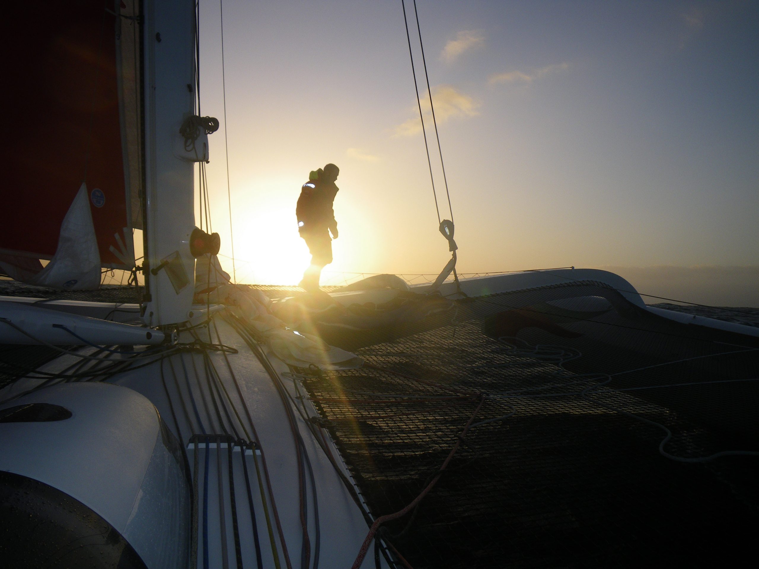
Hooch checking things forward after the night
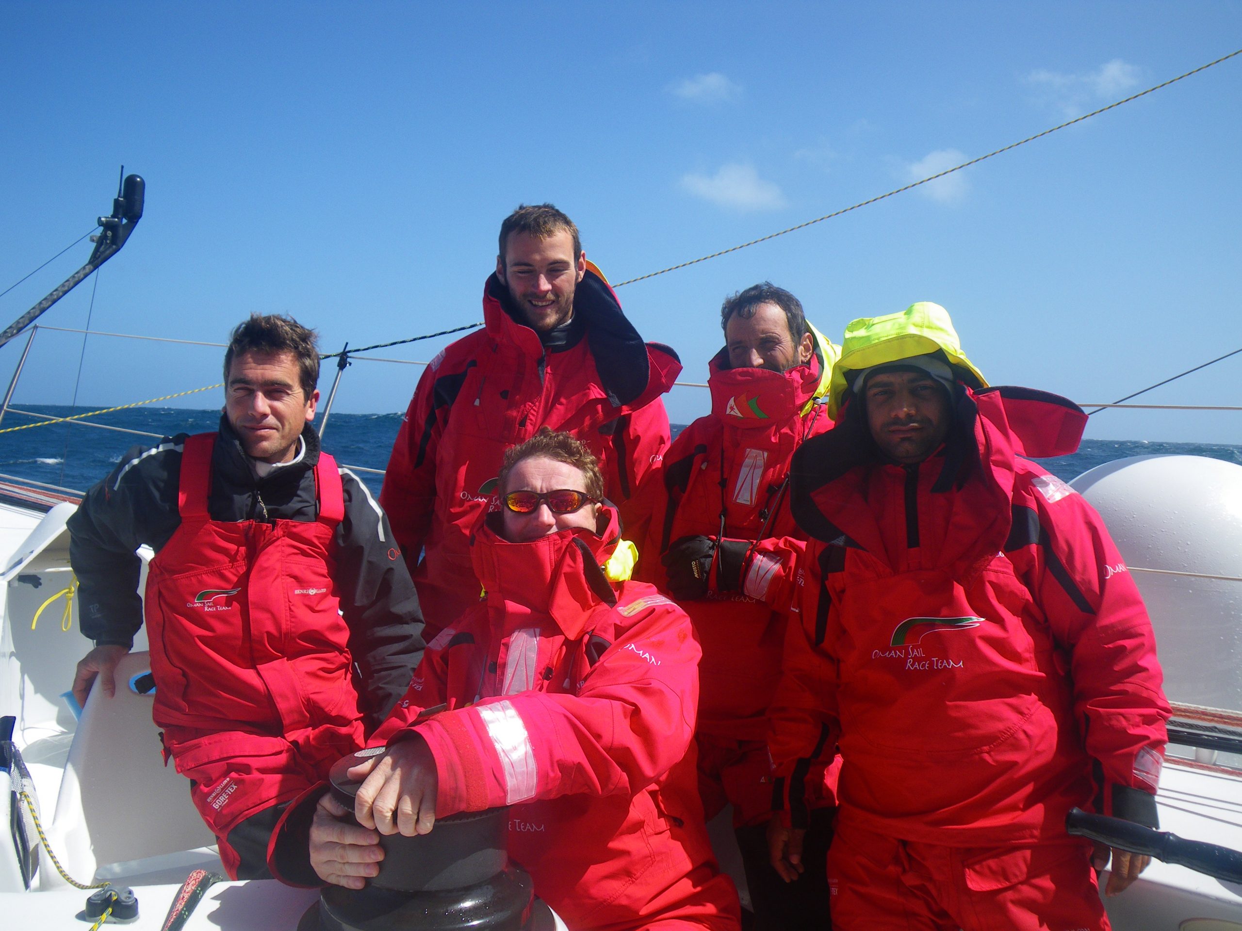
The Team

In the office
Email from the boat to shore:
From: OmanTri
To: update
Subject: Friday morning
Date: 27/02/2009 02:30:42
Hmmmm
not sure what to say really – we are moving along well… we have 1 reef and
the solent and seem to be alternating between 14 and 27 kts of boatspeed
depending on what’s happening underneath us. The waves have not been huge
this trip so far, quite the reverse, but whatever their size they have an
impact on us (quite literally sometimes) the small swell that is running now
lifts us up and doubles our boatspeed….
We saw a whale in the distance, it was quite far off and I wasn’t sure what
i was looking at – but it was the spray from the blow hole – it looked so
like a childs drawing of a whale blowing that I couldn’t quite believe
it…then a few mins later Hooch saw it’s tail. It was far off in the
distance thankfully – as Loik said at the time – whales and Ice bergs –
better in the picture books than in reality. I must say a collision at this
speed isn’t really worth contemplating, it’d be a mess, from 20 odd knots
to stopped or a few knots would put most of us in hospital – 2000nm from the
nearest hospital! We continue to hope that the eyes on front of Mobi help
us, and that the vibrations from the daggerboard and rudders wake up
sleeping whales, and deter those that are awake. As much as we’d love to see
these great creatures up close, we’ll save it for the whale watching safaris
and keep our distance on this trip thanks.
But life does just tick along, we have had some great emails from the
website, from all over the world, lots from Oman thank you! but also from
Canada, Australia, France, UK, and Spain. All offering words of
encouragement, and urging us on to the finish – now somewhere around 3 weeks
or less away.
Some of these messags serve as a reminder sometimes how long it’s been. All
the things we have seen so far on the trip actually seem like yesterday, and
yet far ago. Leaving Muscat is a vivid memory, vivid enough for this to be
the first update just hours after leaving, where as it’s the 50th, and so
all at the same time leaving the moutains of Muscat behind seems an age ago,
the same for seeing Cape Farewell, and leaving New Zealand, and of course
Cape Horn, all vivid memories, but some how long ago. I think this reflects
two things about sailing non stop around the world – the short term nature
of your focus, and any long term thinking is forwards rather than
backwards. The short term stuff is what we need to do now and in next 6
hours to keep on track, sail changes, battery charging, water making,
running repairs etc. The longer term stuff is all about how we get to the
end more quickly and safely.
Looking forward now a bit, we are still figuring out how to make the
transition from being South to heading North. there is still quite a huge
blocking high pressure system that is moving fairly quickly. which leaves
us with headwinds, our choice of routes makes us decide between more wind
upwind for a shorter time,or less wind upwind for a longer time – between a
rock and a hard place…. yes kind of. We still have a few days to figure
this one out and allow the weather models to decide what’s going on – then
we’ll have to work out which is the lesser of two evils and stick to our
guns… once we have decided that’ll pretty much be it – unless we want a
few days stuck in the center of the HP system, no wind and sails slatting
from one side to the other – no thanks – there is enough of that to come
near the equator.
Second email from the boat:
From: Commanders’ Weather
To: OmanTri
Subject: Re: Oman Tri
Date: 27/02/2009 15:36:13
Hi Charles,
At this time, my plan is to get over to 60-65E and then go straight N. Will
adjust a little left or right to find the shortest way thru the doldrums.
Yup 21S/64E is fine for right now.
Will be in the office for much of the next week, so can help out going N.
All good.
Kind regards, Ken Campbell
On Fri, Feb 27, 2009 at 9:51 AM, OmanTri wrote:
> thanks for latest commentry
> looks good – we are fast now, ave 19.7 for last 4hrs
> can you give a rough game plan tomorrow’s update for what we want to do
> going north – for now I’m working on a routing point somewhere 450nm E of
> Reunion ( 21S 64 E) is this a realistic point or should we be a long way
> one side or the other!
>
> thanks
> Charles
>
Weather Router’s advice:
From: Commanders’ Weather
To: Charles Darbyshire , updateoman ,Musandam
Subject: Weather 2/27/09
Date: 27/02/2009 14:11:37
To: Charles Darbyshire and the crew of
ìMusandamî
From: Commanders Weather Corp
Event: sail around the world
Last Position: 41 52s/12 46e at 1230utc Fri Feb 27
Prepared: 1300utc Friday, February 27, 2009
SummaryÖ
1) I agree Charles ñ we should try to route S of the high pressure cell
a) big issue is getting back to the N at an appropriate time, which I
think we can do between 55-65E
2) High pressure cell at 1200UTC Fri is near 38-39S/5W and will move ESE
a) looks to stay along or N of 43S, as it moves E between 30-50E
b) I take you to 44S and this avoids much of the Aghulas current features
3) SW winds will remain fresh thru Sat
a) I have you aiming for 42 30-43S/18E and then 44S/28-30E. We can go a
bit further S, but I hesitate to go S of 45S since we do have to get back to
the NE by 60-65E
4) By 1200UTC Sun, the high will be very close to you at 42-43S/30-35E
a) cold front will be near 50S/11E to 40S/2-3E
b) your SW winds on Sat will diminish and veer into Sun ñ we hold
starboard until the winds become 260 and then we go to port
c) would like to hit 40S around 55-60E, but going too far N too soon will
give you NE winds while the favorable NW winds will be found closer to 45S
d) bottom-line, fast starboard, staying N of 45S, until the winds
diminish and veer and then optimum angle for 40S/55-60E
5) We should fall behind the high pressure cell Sun night/Mon with the winds
becoming N and NNE
a) winds further right to the N and winds further left to the S, but
really want to hit 40S by 55-60E ñ okay to miss a bit further E than W
6) Cold front will be slow to approach, as the high pressure cell slows and
builds E of 60E
a) N and NNE winds slowly increase Mon ñ Tue
7) Will not be a smooth transition Wed ñ Fri into the trade winds as the
cold front will be slow
to move NE
a) trade winds look great N of 35S/between 60-70E, but may be sticky
getting there
RoutingÖ
1) Starboard gybe as fast as practical, aiming for 42 30-43S/18E and then
44S/28-30E
a) okay to be a bit further S
2) Once the high passes and winds become light N and NNE, aim for 40S/55-60E
a) okay to be a bit further E, if necessary
Wind directions are TRUE, wind speed in kts, and time is UTC
Fri, Feb 27
18: 220-250/20-26
Weather…Cloudy to partly cloudy
WSW seas of 10-15 feet
Sat, Feb 28
00: 230-250/20-26
06: 230-250/22-30
12: 220-240/20-25, nr 42 30s/23e
18: 215-235/18-24
WeatherÖMix of clouds/sunshine and maybe a brief squally shower or 2. WSW
seas of 10-15 feet continue
Sun, Mar 1
00: 220-240/18-12
06: 220-250/ 8-14
12: 230-260/ 7-13, very close to the high near 44S/32 50E
18: 340-020/ 4-8
WeatherÖPartly cloudy with WSW seas down to 5-7 feet. A N and NE swell will
develop overnight
Mon, Mar 2
00: 360-020/ 8-14
06: 340-360/10-15
12: 350-010/12-17, near 42 20S/40 10E
18: 360-020/14-20
WeatherÖPartly cloudy with a small WSW swell and a N swell increasing to 5-8
feet
Tue, Mar 3
00: 350-010/16-22
06: 350-010/16-22
12: 350-010/17-23, near 41 20S/49E
18: 350-010/20-25
WeatherÖPartly cloudy with N swell increasing to 6-10 feet ñ will take
little nibbles to get back to the N
Wed, Mar 4
00: 350-010/20-25
12: 350-010/16-22, near 40S/57 30E
WeatherÖPartly to mostly cloudy with N swell of 6-10 feet, maybe a bit more
Best regards, Ken Campbell
—
PLEASE NOTE: AS OF JANUARY 1, 2008, OUR NEW EMAIL ADDRESS IS :
info@commandersweather.com
Commanders Weather Corp.
Tel: 603-882-6789
A selection of pictures from today: