Day: 157
Lat: 36 52.86′ S
Long: 103 47.83′ E
Inst Speed: 25.6
Wind Dir: 345
Wind Speed: 20.5
Distance last 24hr: 369.8
Distance to finish: 16888.6
Long: 103 47.83′ E
Inst Speed: 25.6
Wind Dir: 345
Wind Speed: 20.5
Distance last 24hr: 369.8
Distance to finish: 16888.6

Lunch preparation – Cottage & Shepherd’s pie
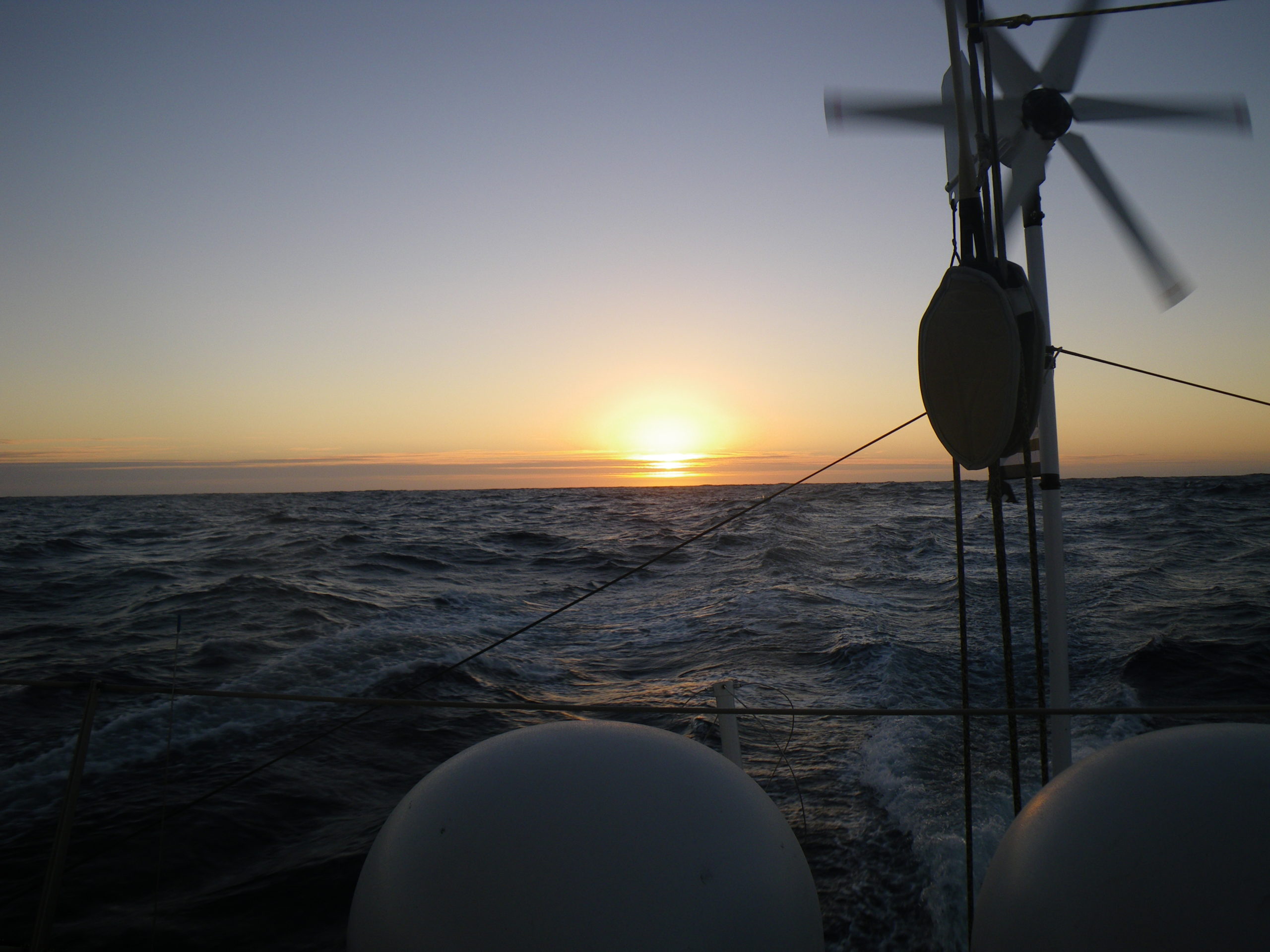
Sunset at almost 40 degrees South
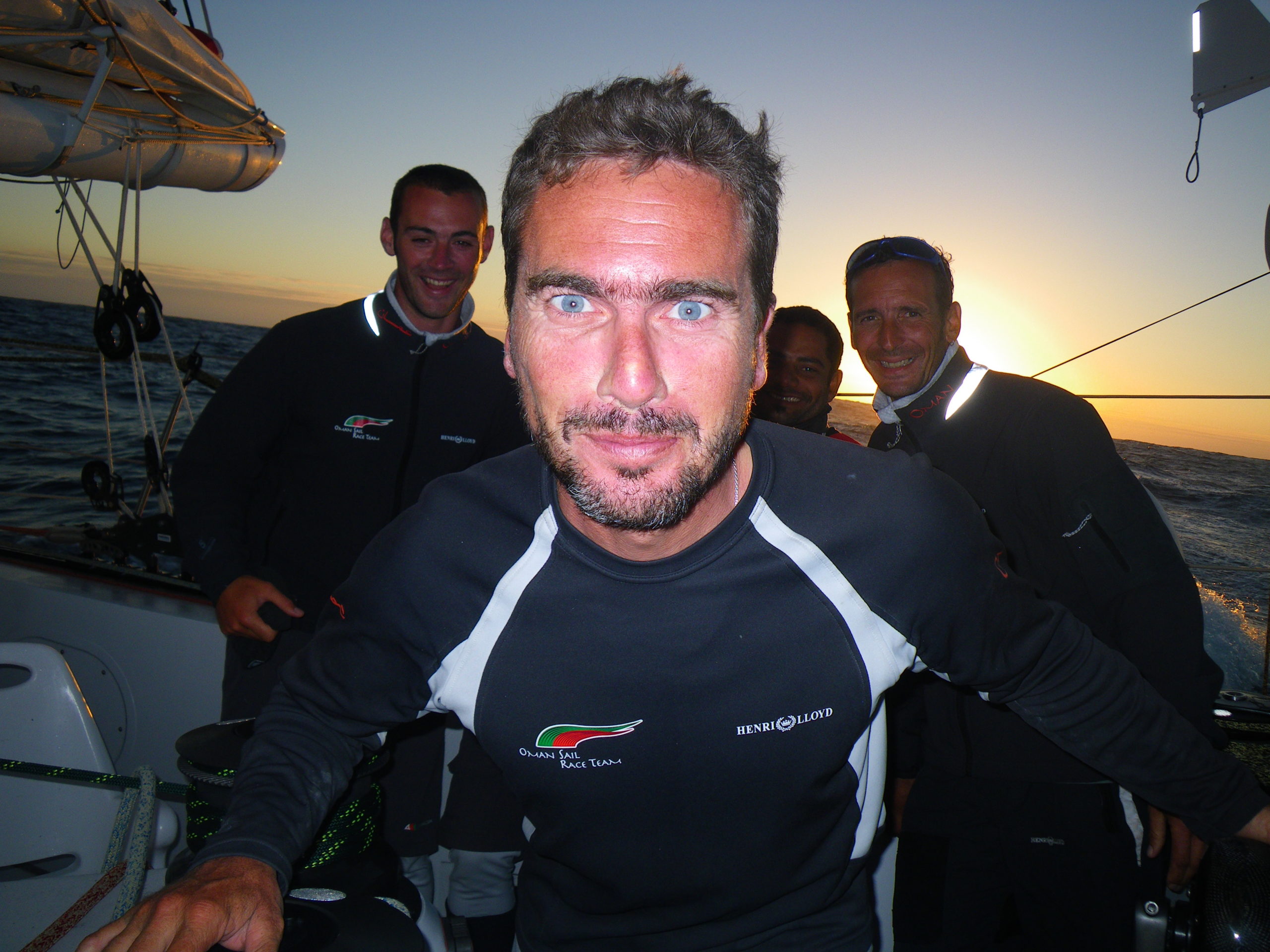
Loik sets up the camera for a sunset team pic
Email from the boat to shore:
From: OmanTri
To: update
Subject: more george
Date: 25/01/2009 03:26:13
I was going to use today’s update to tell you about some great sailing
yesterday – full main and gennaker at a fair pace in the right direction, to
tell you about a great nights sailing where I filled in a few watches for
Loik and Theirry where it never really got properly dark, but everything
turned to shades of grey apart from our B&G instrument displays that glow
red and green. I was gong to describe the sea birds all around us playing
in the disturbed air created by the sails – how the career in from to
windward and behind and soar off in many different directions in the lee of
the mainsail. I could have spent quite a long time discussing the fantastic
stars we had overnight, about shooting stars and satellites passing over
head, or the great pace we are enjoying out here, but just before it came
time to sit down and put these thoughts in an email George’s alarm went off.
(George is our diesel generator for those new to reading these updates)
George was thirsty, George wasn’t getting any cooling water. Loik and I
checked the waterbox which is the main supply of water to the generator and
the watermaker and found it to be empty – either there was an air leak
somewhere or the impellor in the George was damaged. Engine cover off, tool
box out for yet again, removing the old impellor and a quick inspection
found it to be damaged. Into the storage boxes in the back, new impellor –
fit that ( after mopping up the water that came into the forward cabin
during the change ) connect up our start wires and restart- YES water was
once again flowing through George. What a relief. All this whilst jetting
along at 22kts of boatspeed down wind with full main and gennaker in
23-25kts of wind.
Any way the George drama really has induced some writers block – ( Hoochie
sat down with the email last night to write an update and got a block too! )
Mohsin is tapping away at the computer next to me – so i’ll make sure he
sends an email to y’all today. Whilst i’ll go and find something more
interesting to take pictures or film than repairing George – he does seem to
steal the limelight.
Weather Router’s advice:
From: Commanders’ Weather
To: Musandam
Subject: Weather 1/25/09
Date: 25/01/2009 14:11:38
To: Charles Darbyshire and crew of “Musandam”
From: Commanders Weather Corp
Event: sail around the world
Last Position: 37 06s/106 54e at 1145utc Sun, Jan 25
Prepared: 1300utc Sunday, January 25, 2009
SummaryÖ
1) Thank you for getting some southing in. It will help, but
a) high pressure will go from the GAB to S of Tasmania then NE to just SW
of the Cook Strait ñ it is going to get light and we will need to be
patient, but being further S will certainly help, a lot!
2) Cold front is located from 40S/104E to 35S/97E
a) front will arrive in about 24 hrs and at that time we will go
starboard gybe and sail fast to the SE
b) until the cold front arrives, sail as fast as possible to the E, maybe
soaking a little south
3) Remember, the NW and WNW winds preceding the Southern Ocean cold fronts
feature quite
stable wind conditions, milder temps, and better sea state
a) tomorrow’s cold front will bring a wind shift into the W and SW. This
new breeze will be gusty and unstable while 20+ kts and the sea state will
be rougher. It will NOT be a strong cold front, by Southern Ocean standards,
but it will be rougher than it has been ñ we do need to get SE, when the
cold front passes
4) By 1200UTC Tue, the high pressure will be centered near 42-43S/123-125E
going to just S of
Tasmania to 43-44S/160-163E
a) winds will become very light during Tue
b) when winds become very light, always try to go further S, not SE or E,
but get some southing
5) We may be playing with the western edge of the high pressure ridge on Wed
and Thu
a) anytime we point to the E or ENE, we may sail closer to the high,
since we will be moving faster than the high pressure ridge will be moving
6) Good news, it looks like a cold front next weekend should clear out all
of the high pressure areas
and allow a good sail towards the Cook Strait
a) we just may have be very patient Tue thru Fri
RoutingÖ
1) Fast as possible to the E until the cold front passes. Any little bit of
southing will be helpful, but
better to be fast to E and stay E of the cold front for as long as
possible
2) When cold front passes in about 24 hrs, then fast as possible to the SE
3) Will be some light wind periods Tue ñ Fri, so favor more south than east
while routing during light
wind periods
Wind directions are TRUE, wind speed in kts, and time is UTC
Sun, Jan 25
18: 300-320/20-25
WeatherÖPartly cloudy with W and WSW swell of 6-9 feet
Mon, Jan 26
00: 300-320/20-30
06: 310-270/20-25, gust/squall to 30kts and maybe go to starboard on this
leftie
12: 260-230/20-25, gust/squall 30-35kts and on starboard near 38s/116e
18: 220-250/17-23
WeatherÖPartly to mostly cloudy with scattered showers/squalls as the cold
front moves thru, but trending to partly cloudy as winds become SW. Seas up
to 8-12 feet for a while from the W and SW
Tue, Jan 27
00: 230-200/18-12, lighter winds to the N
06: 220-190/16-8
12: light/variable, near 40 30S/123 10E and drifting S
18: 310-350/ 7-14, may have to go back to port
WeatherÖPartly cloudy with SW seas of 5-7 feet and improving
Wed, Jan 28
00: 330-360/10-16
06: 340-310/16-10
12: 300-320/10-15, going to port near 42 50S/129 50E
18: 300-270/14-8, may have to go to starboard again
WeatherÖPartly cloudy Wed ñ Fri with W seas of 4-7 feet
Thu, Jan 29
00: 280-310/ 8-16
06: 290-310/10-15
12: 290-310/10-15, near 44S/136E
18: 300-270/ 8-14, may go to starboard for a little time again
Fri, Jan 30
00: 270-300/ 8-14
12: 330-360/10-15, near 46 30S/141E and preparing to sail ENE on port
Best regards, Ken Campbell
—
PLEASE NOTE: AS OF JANUARY 1, 2008, OUR NEW EMAIL ADDRESS IS :
info@commandersweather.com
Commanders Weather Corp.
Tel: 603-882-6789
A selection of pictures from today: