Lat: 23 15.79′ S
Long: 74 07.53′ E
Inst Speed: 15.8
Wind Dir: 122
Wind Speed: 19.7
Distance last 24hr: 273.16
Distance to finish: 18697.86
Long: 74 07.53′ E
Inst Speed: 15.8
Wind Dir: 122
Wind Speed: 19.7
Distance last 24hr: 273.16
Distance to finish: 18697.86
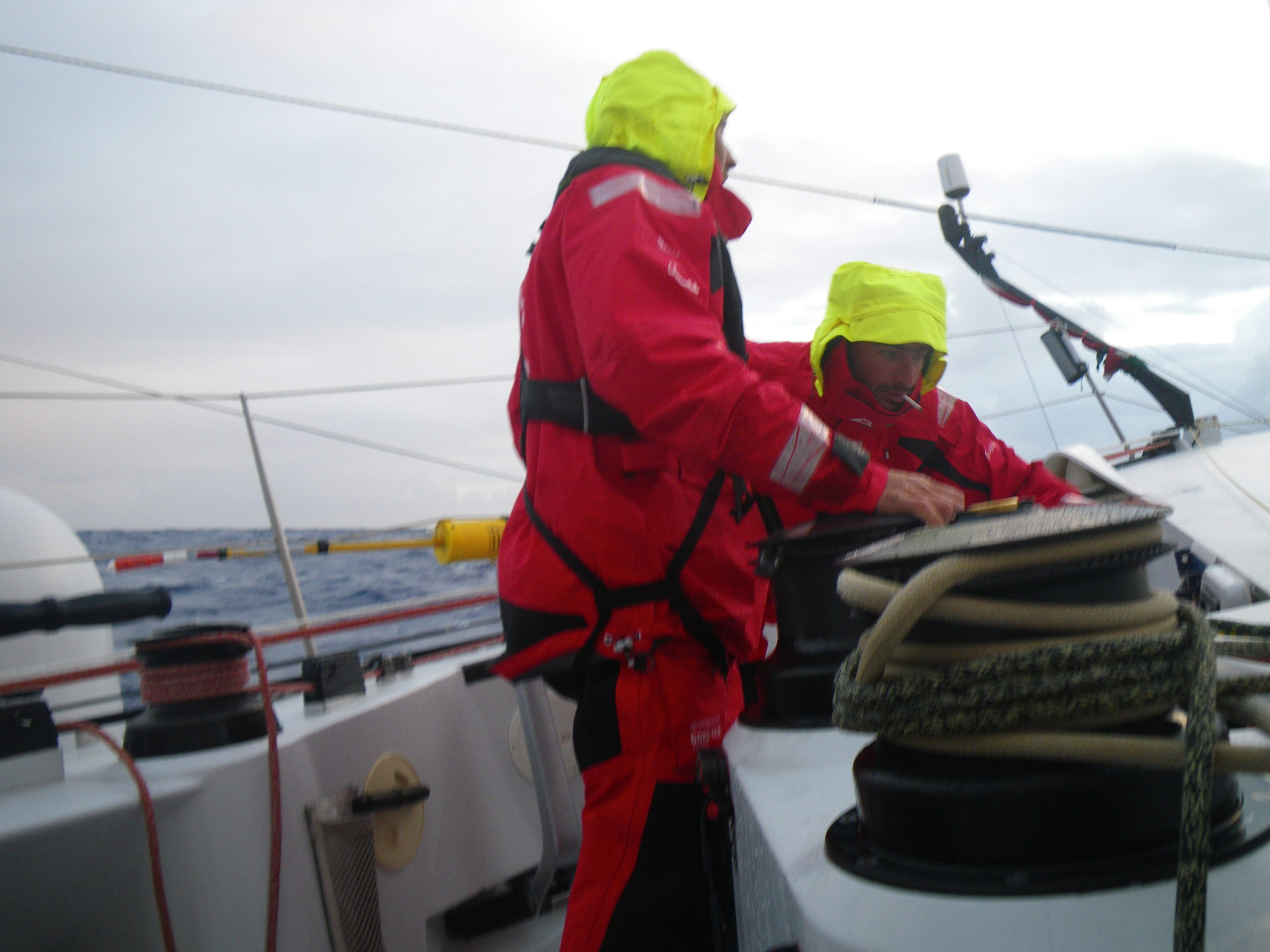
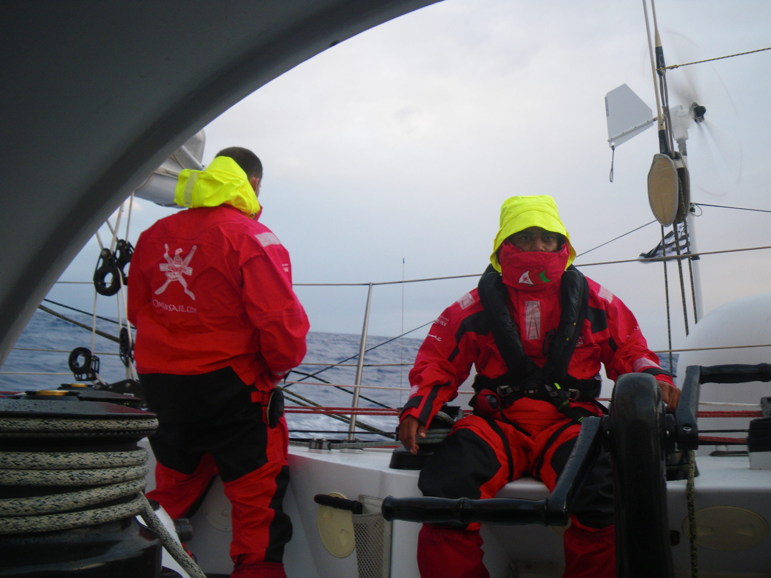
On watch heading south…
On watch heading south…
Email from the boat to shore:
From: OmanTri <omantri
To: update <updateoman
Subject: food bag day 11
Date: 19/01/2009 03:13:00
Hi Folks
we have just divided out food bag 11 into the pockets we have in the
alley – for main meals, snacks, drinks etc this daily ritual occurs around
midnight/ 1am gmt each day – when we see what we’ll be eating for the next
24 hours. today we have chicken curry, and cottage and sheppards pie ( a
favorite ) The food bags for day 5 -20 were stored in the sail locker
forward, so each day rather than getting fully dressed in wet weather gear
to make the journey forward to get the food bag, i clamber through the small
hole in the bulkhead between Generator compartment and the sail locker to
recover the relevant day bag. The hole is about the size of me, and on each
side are obsticles to get over or around, and especially on the generator
side a canvas bunk which is best not to point load. This is a fairly simple
task when tied to the dock- but out here at the motion is quite rough and
getting though without too many bruisies or scratches is an art.
So what’s the motion like – well last night it felt like i’d been tied up
and put in the back of a van and driven along a fairly strait country road
but with big puddles – the ones that slow you down if you drive through
them quickly, although fairly secure in the bunk – the motion is not really
up down so much – it’s more like surging – often forwards, but also as the
helmsman bears away abit to alghn a wave, or heads up afterwards is a
sidways swerving motion. Not too unpleasant, just keeps you awake longere
than you need .
Being out of the watch system makes finding a balance quite hard – any time
you are in the bunk, you feel guilty that you are in your bunk, and when you
are tired and not in your bunk you just wanna get some sleep – but you look
at the clock, and there is 55 mins to the next scheduled weather report , or
call to the office, or time to start the generator….I have a kitchen
timeer that goes to 99 mins that i have been using quite a lot to enable me
to sleep and still make the scheduled tasks on time. I try to get a 3-4 hour
sleep in sometime between 9pm and midnight, and then something in mid
afternoon – i am however the on call person to help with a manouver on
deck- luckily about 50% of the time the lads can do the sail change without
me – but in some conditions is easier safer and faster to do them with 3. I
really like hanging out on deck – getting the sea air, and have made a
resolution to spend more time up topside!!!
Weather Router’s advice:
From: Commanders’ Weather <info
To: Musandam <omantri
Subject: weather 1430 UTC Mon 1-19
Date: 19/01/2009 14:36:16
To: Charles Darbyshire and crew of “Musandam”
From: Commanders Weather Corp
Event: sail around the world
Last Position: 19 18s/ 74 07e at 1200utc Mon, Jan 19, 2009
Prepared: 1300utc Mon, Jan 19, 2009
SummaryÖ Nice trades will diminish and back next few days
1) High pressure near 34s/90e this morning will move little next 24 hours
then evolve westward
to 33s/ 84w by 12 utc Wed.
a) Then shift eastward to 32s/ 92 e by Friday.
2) Best boat speed S then SE as winds back to N
2) Still like a temporary gybe to S on Starboard as winds back to NW after
12 utc Wed to avoid getting
sucked into the high.
3) Get down to 36s before gybing back to port and heading ESE if staying on
the northern route.
4) Winds will diminish to 10-14 kts by 12 utc Tue and a little lighter by 12
utc Wed.
5) Then expect increasing NW from approaching frontal system 12 utc Thu.
a) Speeds get up to 25-30+ kts around 37s
b) Will be stronger to the S and lighter to the N
c) Seas also will be higher to the S.
6) So taking this front further N will be better for you.
7) But the problem comes after frontal passage when small area of high
pressure follows the front
along 40s heading toward 90e by next Sat.
8) You need to avoid the light air from this high and staying on the
northern route this will be difficult.
9) Getting south to near or south of 42 will get you S of this high and
into more consistent westerly
winds.
RoutingÖ Have adjusted routing further N closer to your waypoint on last
email to show you expected
conditons. The concern toward the weekend will be light
air from the main high which will
be to your N and also new high pressure cell following
cold front which will be to your
south.
You will have to be near 36-37s and 90e Sat to avoid
becalmed by the high to your S and
close to the high to your N to get what breeze you can
from this high then.
Stronger winds eventually fill in from NW as next front
approaches a week from now.
But you may have to get S a week from now. for better
wind speeds and with NW winds
this not ideal situation.
Understand concern with winds and seas further S But
normally we would get you down
near 42-45s and into more consistent westerlies. There
will be higher winds and seas to
deal with there for sure on average and also the
slight chance you may have to deal with
NE headwinds. But it could be much faster than the
northern route.
You still have until Wed to decide if you want to get
S of the high cell following the cold
front late week.
Estimated positions below.
Wind directions are TRUE, wind speed in kts, and time is UTC
Mon, Jan 19
18: 080-100/15-20
WeatherÖPartly cloudy
Seas 6-10 ft E swell
Tue, Jan 20 ñneed to be careful about getting sucked E into high
Winds stronger W and lighter E
00: 060-080/14-18
06: 050-070/12-16
12: 040-060/10-14 nr 29s/ 74 20e
18: 030-050/10-14
WeatherÖPartly cloudy
SeaÖ 5-8 ft developing SW swell
Wed, Jan 21
00: 360-020/ 9-13
06: 350-010/10-14
12: 330-350/ 9-13 nr 33 30s/76e
18: 310-330/10-14 ñ gybe to starboard and head S to avoid light air to the E
WeatherÖPartly cloudy
Seas 6-9 ft SW swell
Thu, Jan 22 ñ winds stronger to the S
00: 310-330/ 13-17 Gybe to port and heading ESE
06: 320-340/ 18-25
12: 310-330/ 18-25 nr 37s/ 79e
18: 320-340/ 22-30
WeatherÖPartly cloudy
SeasÖ6-10ft higher to the south
Fri, Jan 23 – winds stronger to the S
00: 300-320/ 25-32
06: 300-320/ 22-30
12: 280-300/ 18-25 nr 37s/85e
18: 270-290/ 15-20
WeatherÖPartly cloudy to cloudy with a squally shower possible
SeasÖ7-10 ft ñ higher to the south
Sat, Jan 24 ñ winds now lighter to the S
00: 270-290/ 12-17
12: 270-290/ 10-15 nr 36n/ 91e
WeatherÖPartly cloudy
Seas 8-12 ft ñ W swell
Best regards,
Tom Mattus
A selection of pictures from today: