Lat: 1 53.35′ S
Long: 66 37.44′ E
Inst Speed: 20.5
Wind Dir: 77
Wind Speed: 15.3
Distance last 24hr: 397.40
Distance to finish: 20064.88
Long: 66 37.44′ E
Inst Speed: 20.5
Wind Dir: 77
Wind Speed: 15.3
Distance last 24hr: 397.40
Distance to finish: 20064.88

Loik on watch after bumping over the equator – milestone achieved
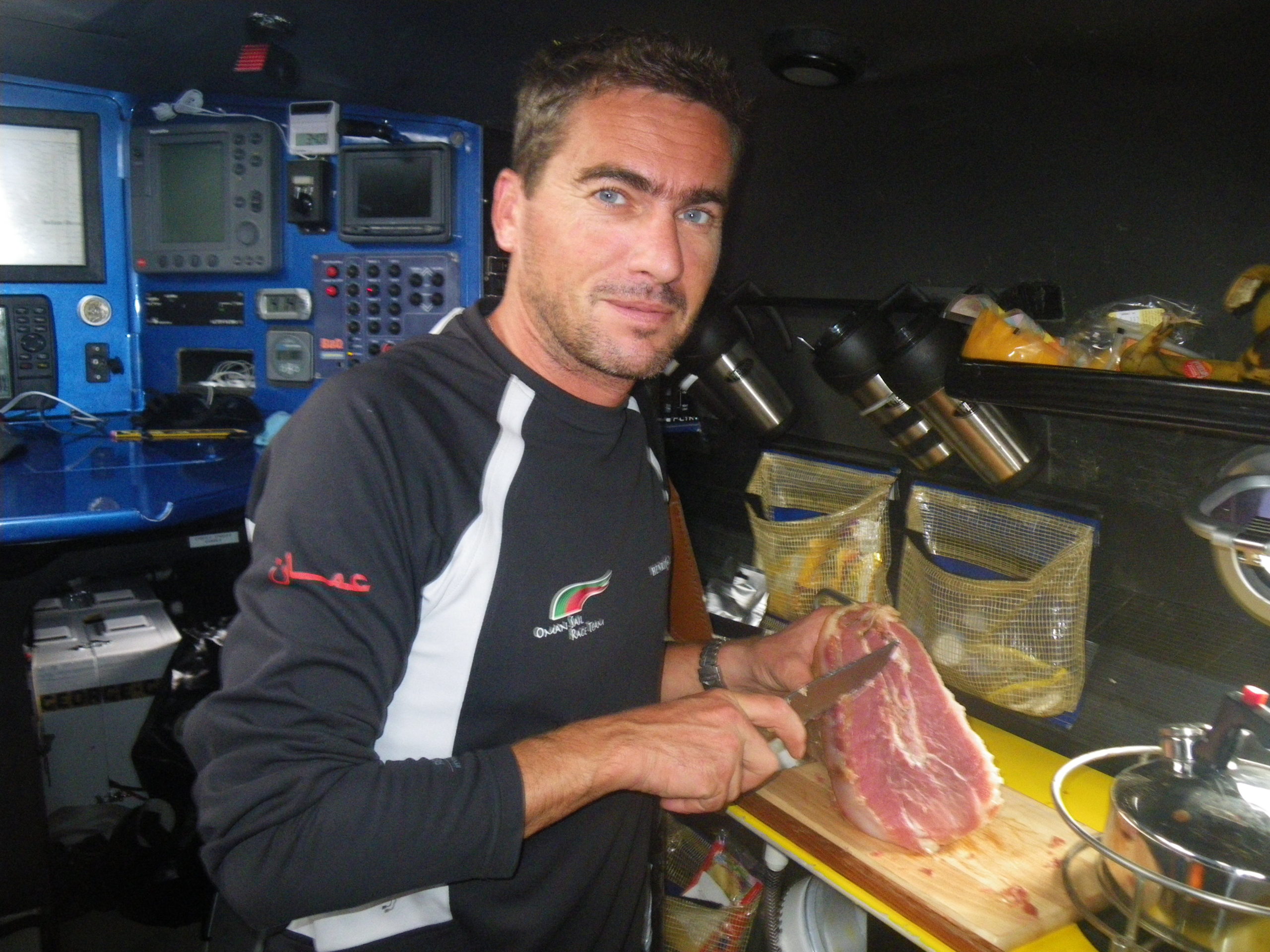
Celebration ham, kind of a french ocean sailing tradition
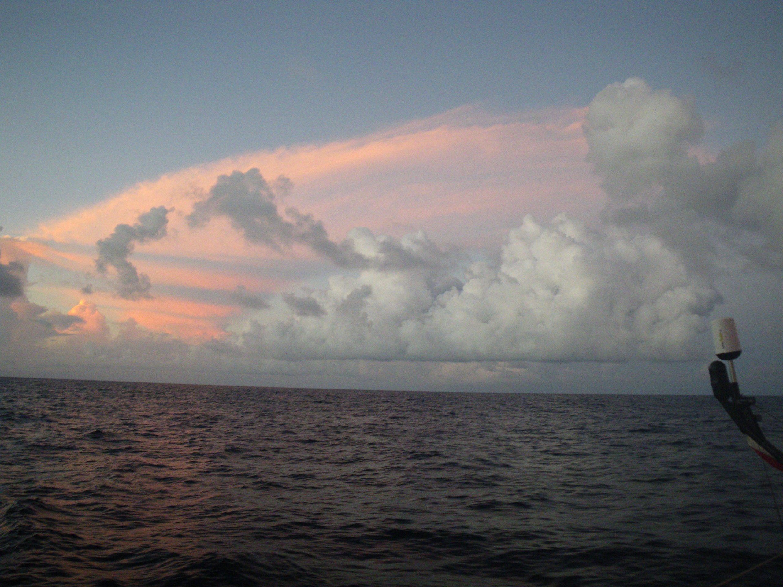
Doldrum clouds – the doldrums in the Indian Ocean are further south than in the Atlantic
Email from the boat to shore:
From: OmanTri <omantri@
To: update <updateoman@
Subject: equator – DONE
Date: 13/01/2009 06:29:30
in one direction at least ! we crossed the equator at 1208 UTC today 13 jan
i think that we were all a bit tired – there was a bit of a delayed cheer
but we were all happy to reach this milestone. it’s early in the trip, but
it was good to get into the southern hemisphere and have that part of the
trip done – from here on the days get longer and cooler which will be a
relief.
We have done some more work on the generator and now have a sustainable fix
that should see us round the world ok – we have take out the start battery
and have a couple of flying leads that we can connect either to the main
engine battery or the main system batteries to start the generator – one
runnning we can take off the clips and she runs well – we are charging
approximatly twice per day for around an hour each time though this depends
on the apparent wind speed we have – as the wind generator can be very
effective, or not at all depending on how much wind we have.
Loik and I are not sleeping a lot, but when we do something seems to
happen…. last night i finally got to sleep and woke up to find theirry and
hooch with a problem with the compass the heading had drifted around 30
degrees, so i went into the back of the boat to see if there were any
connection problems, or to see if anything could have effected the
compass….nothing found, so whilst scratching my head a bit i picked up a
safety waist bag that we all have from the cockpit floor – and the compass
corrected. Problem solved – the safety waist bag contains a man overboard
beacon – to activate the beacon you remove it’s jacket which trips a
magnetic switch…. the magnet was right above the compass which is mounted
below the cockpit floor…. I just wish all these things were as easily
solved.
also on the work list for today is to put back some of the instrument system
we disconnected trying to find a small problem, we may do that tomorrow
though when winds are likely to be calmer…. for now the sailing side is
pretty good – couldn’t be too much better we have a good course making good
progress south – we have some doldrum weather to cross later this week but
after that the prediction is still good for a good rotation from south to
east around the high pressure off australia. by then it will be much cooler,
and much more daylight hours.
Second email from the boat:
From: OmanTri <omantri@
To: update <updateoman@
Subject: pretty nice night out here
Date: 13/01/2009 15:24:10
so the breeze has dropped off as forecast, but not too much, and we are
still making good progress south, the latest models show wind to the east
for later in the week, and the discussion wtih Commanders weather has meant
we’ll be working our way south east across the doldrums these next few days
in an attempt to get to the new wind earlier… it’s a bit of a gamble –
ususually crossing n to s is best as it’s shortest – but there are light
winds to the south too, so if it pays off it will set us up nicely for the
next week and our decent to 35 degrees south which is approximately we’ll be
able to turn left and head east under the australia high pressure, and on
top of a southern ocean low.
this cause brings us close than we though to deigo garcia an atol i think
made famous as a US military base they must like beng posted there as
weather is beautiful, and the sky tonight is spectacular – cloudy to the
north – but ahead of us the stars are special.. the moon has yet to raise –
hence the intensity of the stars… the sea is fairly flat, and the evening
is warm…. hard to think how it could be better…
Date: 13/01/09
Time: 15:20:00
Posn: 0411.1692S 06714.8210E
Ave Boatspeed last 5 mins:12.00
Ave TWD last 5 mins: 050
Ave TWA last 5 mins: -89
Ave TWS last 5 mins: 9.4
Ave SOG last 5 mins:12.32
Ave COG last 5 mins: 147
Ave Pressure last 5 mins: 12.1
Sea Temp: 28.1
Air Temp Fwd cabin: 30.8
Weather Router’s advice:
om: Commanders’ Weather <info@
To: , Musandam <omantri@
Subject: New Routing Tue 12 utc 1-13
Date: 13/01/2009 12:32:10
Charles,
Accuracy of grib files in the Doldrums are usually poor to
say the least. Very difficult to rely on wind directions.
Usually you have to take what wind you have a try to get S as best you can
to get thru them the quickest. Heading SE is not normally
good strategy as a general rule.
But looking at the latest gribs(6UTC) from GFS there is increasing ESE-E
wind late this week to 10+ kts E of a line from: 6s/75e to 10s/ 73 30e to
13s/73e to 15s/68e. This wind is the northern portion of the circulation
around the big high to the S down near 30-35s and is the trade wind regime.
This is what we should aim for and in this case it is closer to head SE to
get East of this line rather then S.
Your routing supports this. But keep in mind that model guidance in the
Doldrums is erratic and subject to change. You will likely
get into < 5 kts of wind for a time and there may be S winds forcing your E
for a time on Thursday. We have you getting into this wind
18 utc Thu near 7-8s and 73-74w.
Will follow with detailed forecast within the hour.
Tom Mattus
From: Commanders’ Weather <info@
To: Musandam <omantri@
Subject: weather Tue 1-13
Date: 13/01/2009 13:29:54
To: Charles Darbyshire and crew of “Musandam”
From: Commanders Weather Corp
Event: sail around the world
Last Position: 3 14s/ 66 47e at 1200utc Tue, Jan 13, 2009
Prepared: 1330utc Tue, Jan 13, 2009
SummaryÖHave adjusted routing to SE next 48 hours as you may be able to get
to E trades earlier. This agrees with your routing.
1) Should see a significant decline in wind speed next 12 hours as you get
further S and into the
Doldrums.
2) Model guidance in the Doldrums is often erratic and can be unreliable as
systems are more
mesoscale in nature( 50-100 miles wide or less).
3) The larger scale models have a difficult time resolving this smaller
scale so anticipate some changes
in model guidance over the next 48 hrs in the light air of the
Doldrums.
4) As discussed in an earlier email it may be better to head SE as best you
can to get to the ESE-E
trade wind regime earlier.
a) Your routing supports this as well.
5) 6 utc model guidance is showing increasing ESE-E trade winds around the
big high to the south near
30-35s east of the following line on Thu /Fri.
a) 6s/75e to
b) 10s/ 73 30e to
c) 13s/ 73e to
d) 15s/ 68e
6) So it looks like trying to head SE will be about 200 miles closer than
continuing S to get to this wind.
7) If you do that then expect your NE wind will diminish to < 5 kts near or
a little after 12 utc Wed.
a) Breeze could become light and variable for a
time 18 utc Tue.
8) But unlike yesterday the GFS model is transient with this wind hole and
shifts it westward.
a) This allows your winds to become light S-SSE
around/after 00 utc Thu.
9) This puts you on starboard and heading E-ESE which normally is not good
but in this case gets you
to the increasing E-ESE trades earlier.
a) Let’s hope the model guidance is correct.
11) Once in the trades you will be heading S and looks like you can
negotiate the western periphery of
the high in the long term as the high center slides eastward to
30-35s/85-90 E by next Tue.
RoutingÖ You want to get E of the line 6s/75e to 10s/73 30e to 13s/73e to
16s/68e to get into increasing E-ESE trade winds late this week. Heading SE
may get you there quicker than heading S
on the latest 6 utc GFS model guidance
You want to get to 7-8s/ 73-74w by 12-18 utc Thu then can head S into
increasing trades.
Wind directions are TRUE, wind speed in kts, and time is UTC
Tue, Jan 13
18: 050-070/12-16
WeatherÖFair to partly cloudy
Seas 3-5 ft – NE swell
Wed, Jan 14
00: 040-060/ 5-10
06: 050-060/ 6-9
12: 050-070/ 4-7 nr 6 40s/69 e
18: light and variable
WeatherÖVariable cloudiness with scattered squally showers developing
Seas 2-4 ft – NE swell
Thurs, Jan 15 ñ winds backing slowly
00: bcmg 160-180/ 5-8 ñ now on starboard
06: 150-170/ 5-8
12: 140-160/ 5-8 nr 8 s/73-74e Winds stronger to E and S
18: 120-140/ 6-10 – Tack to Port and heading S
WeatherÖVariable cloudiness with scattered squally showers possible
Seas 2-4 ft
Fri, Jan 16 ñ trade winds increasing as you get further S
00: 090-110/ 6-10
06: 100-120/ 10-15
12: 080-100/ 12-17 nr 11s/73e
18: 080-100/ 14-20
WeatherÖVariable cloudiness with scattered squally showers becoming less
frequent.
SeasÖincrease to 3-5 ft
\
Sat, Jan 17
00: 070-090/ 14-20
06: 070-090/ 14-18
12: 080-100/ 13-17 nr 18s/ 74e
18: 080-100/ 12-16
WeatherÖPartly cloudy brief scattered trade wind shower possible
Seas 3-6 ft
Sun, Jan 18
00: 080-100/ 8-12
12: 070-090/ 12-16 nr 24s/ 74-75w
WeatherÖPartly cloudy , brief scattered trade wind shower possible
Seas 3-6 ft
Best regards,
Tom Mattus
A selection of pictures from today: