Lat: 12 28.64′ S
Long: 74 07.40′ E
Inst Speed: 15.7
Wind Dir: 116
Wind Speed: 18.5
Distance last 24hr: 191.46
Distance to finish: 19314.08
Long: 74 07.40′ E
Inst Speed: 15.7
Wind Dir: 116
Wind Speed: 18.5
Distance last 24hr: 191.46
Distance to finish: 19314.08
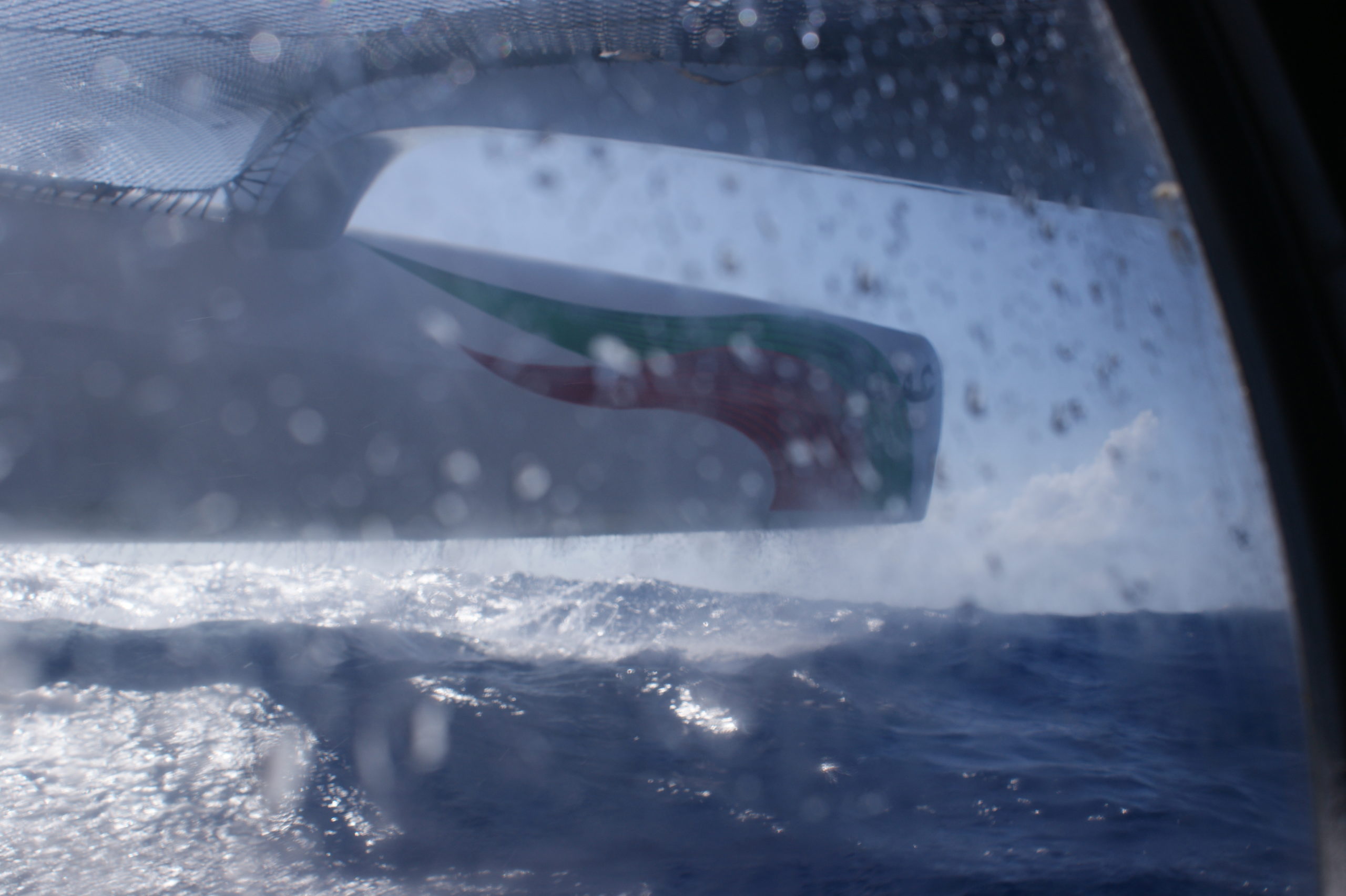
The windward hull jumping over the waves…
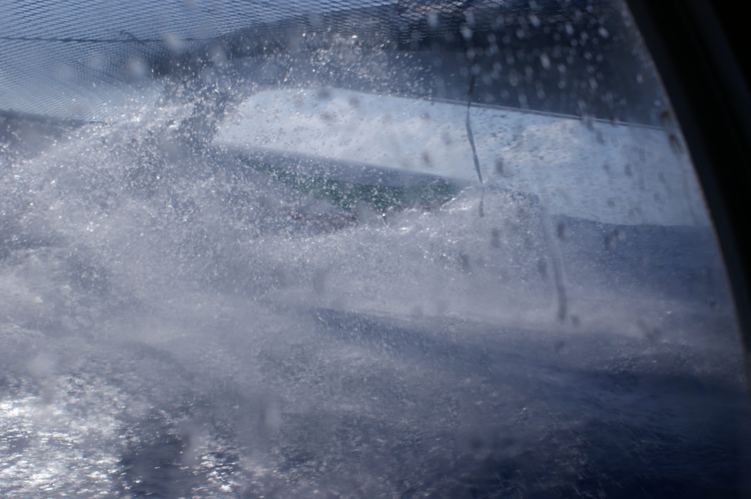
… and through the waves

the motion is incredible
Email from the boat to shore:
From: OmanTri <omantri@
To: update <updateoman@
Subject: good morning folks
Date: 17/01/2009 02:25:47
what a difference a day makes – the wind built through out yesterday until
we were able to be confident that we were east enough to tack south, this
was our escape route through the doldrums – not a classic N – S crossing
but we hoep it’s set us up well for the next few days in good E winds,
allowing us to make good progress south. We are now fetching across the
waves in 16-20 kts of wind, and the boat is banging and shuddering, and makes
it tough to stay in bed. the flip side of this is that the wind generator is
doing a great job – almost keeping up with our electrical needs – and
delaying our having to use George – which whilst it’s still 30 degrees down
below is a welcome relief.
it’s pretty wet on deck with every 3rd or 4th wave coming into the
ockpit – making forwad vision painful on the eyes, and running for a pee
without wet weather gear a challenge. we have yet to cook too…which will
be a job for an hour or twos time – cooking is a relative term of course – i
mean pouring water from kettle into a foil bag, and leaving it for 15 mins.
but with the boat jumping around getting the right amount of water into the
foil bag is a bit of a challenge
Weather Router’s advice:
From: Commanders’ Weather <info@
To:Musandam <omantri@
Subject: weather Sat 1430 utc 1-17
Date: 17/01/2009 14:42:10
To: Charles Darbyshire and crew of “Musandam”
From: Commanders Weather Corp
Event: sail around the world
Last Position: 14 56s/ 74 21e at 1330utc Sat, Jan 17, 2009
Prepared: 1430utc Sat, Jan 17, 2009
SummaryÖ Should have moderate trade winds next few days trending more into
the E
1) You should be into more consistent trade winds now but will continue ESE
thru 12 utc Sun.
2) There is an area of disturbed weather to your south(between 18-27s) with
a lot of cloudiness and a
few scattered squally showers.
3) You will run into this area as you approach 18s so conditions may become
a little more shifty
with wind direction and wind speed as you get further S.
4) Overall wind speeds should be into the 15-20 kt range but there may be
higher gusts near any
squalls and lulls < 15 kts following any showers.
5) Once south of 30 winds will lighten a little in general but still in the
15 kt range.
6) High pressure centered near 35s/82e today will shift E to 35s/88e by 12
utc Mon then may relocate
further W near 33s/ 82e by 12 utc Wed
7) Your winds will lighten and back into the NE-N after 00 utc Tue as you
approach the latitude of the
high.
7) Meanwhile there will be an approaching frontal boundary on Tue/Tue night
coming from the W.
8) You may be able to get into some wind ahead of this front midweek
possibly in the 15 kt range.
a) Direction ahead of the front will be NW.
9) But just how this front affects you is not definite as the band of wind
will be shrinking ahead of it.
a) You will also be closer to the high and much
lighter winds mid week as well.
10) In the mean time enjoy the stronger trades coming up.
RoutingÖ Head mostly S with the ESE-E-ENE trade wind regime coming up.
Avoid getting too much
further E so we do not get sucked into the high later next week.
Estimated positions below.
Wind directions are TRUE, wind speed in kts, and time is UTC
Sat, Jan 17
18: 110-130/15-20
WeatherÖPartly cloudy
Seas build to 4-7 ft
Sun, Jan 18
00: 100-120/15-20
06: 100-120/15-20
12: 100-120/17-22 nr 21s/74e
18: 090-120/15-20
WeatherÖConsiderable cloudiness with scattered squally shower or 2
Seas build to 6-9 ft E swell
Mon, Jan 19
00: 090-110/15-20
06: 080-100/15-20
12: 080-100/14-18 nr 27s/74e
18: 070-090/13-17
WeatherÖCloudy to partly cloudy ñ sct shower threat diminishing
Seas 5-8 ft S swell
Tue, Jan 20 ñneed to be careful about getting sucked E into high
Winds stronger W and lighter E
00: 060-080/12-16
06: 020-040/13-17
12: 010-020/13-17 nr 33s/ 75e
18: 350-010/ 12-16
WeatherÖPartly cloudy
SeaÖ 5-8 ft developing SW swell
Wed, Jan 21
00: 330-350/12-16
06: 320-340/13-17
12: 300-320/13-17 nr 37s/79 30e
18: 300-320/15-20
WeatherÖPartly cloudy
Seas 6-10 ft SW swell
Thu, Jan 22
00: 290-310/ 15-20
12: 280-300/ 12-17 nr 39n/ 86w
WeatherÖVariable cloudiness
Best regards,
Tom Mattus
A selection of pictures from today: