Lat: 27 35.49′ S
Long: 74 00.09′ E
Inst Speed: 11.6
Wind Dir: 131
Wind Speed: 9.1
Distance last 24hr: 353.95
Distance to finish: 18471.29
Long: 74 00.09′ E
Inst Speed: 11.6
Wind Dir: 131
Wind Speed: 9.1
Distance last 24hr: 353.95
Distance to finish: 18471.29

Day 12 team picture heading south
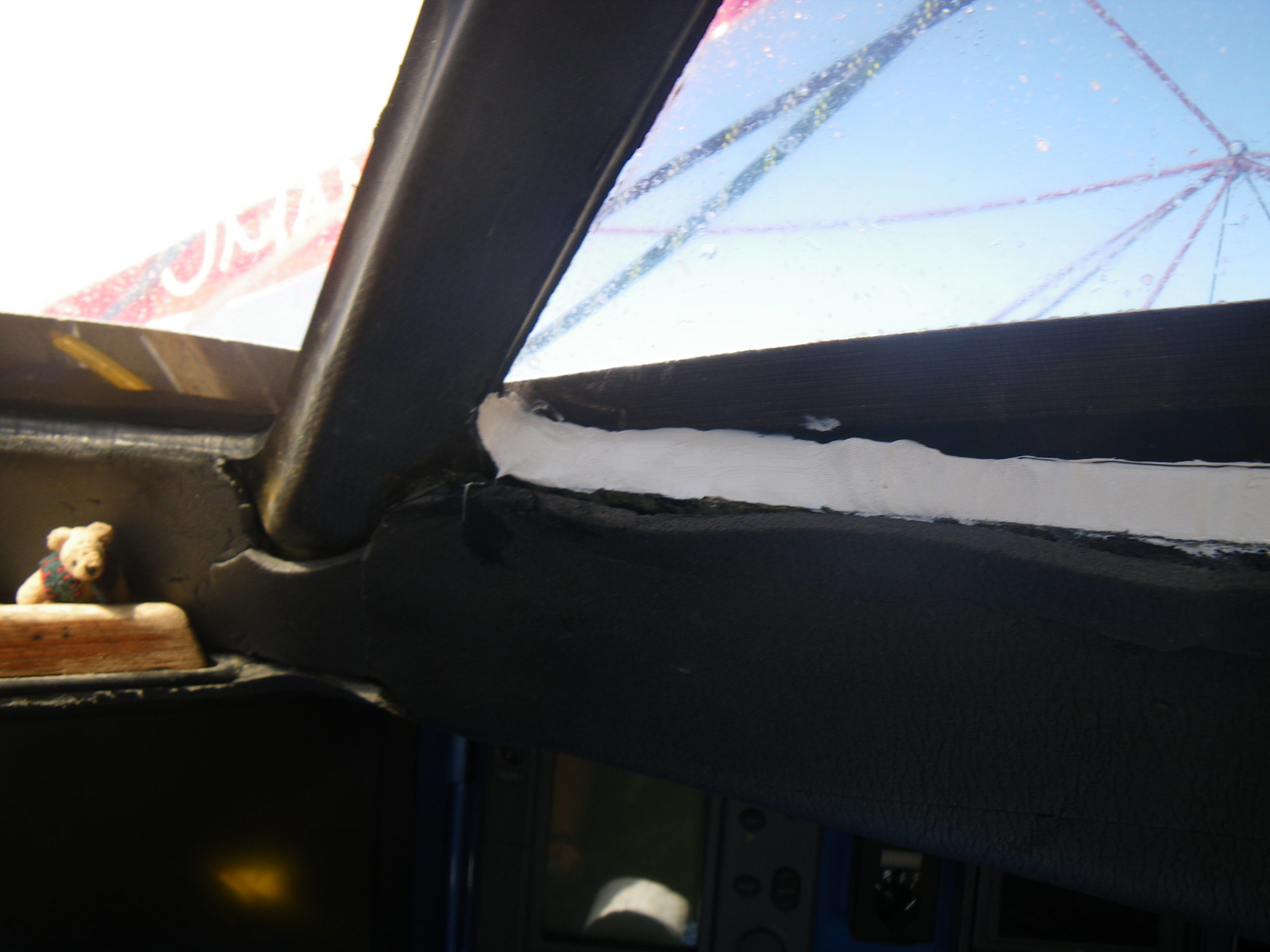
Some maintenance required, this should stop the leak

Sunsets at sea are the best
Email from the boat to shore:
From: OmanTri
To: update
Subject: getting on south
Date: 20/01/2009 02:22:33
We are finally getting into the effects of the high pressure which will
slowly turn us from heading south to heading east. The last 3 days have been
fairly full on with loads of water over the decks – and us as we sailed
fairly close hauled in the SE trade winds – trying to maintain the Easting
that we made in the doldrums – some times we sailed with three reefs and
staysail just to maintain that course. But it gives us some room to play
with now, as we head down the western side of the high pressure the winds
will move more to the NE, then N and eventually NW. We still have a round
36 hours before we decide how we are going to sail this first part of the
southern ocean – we can stay to the north and risk some lighter winds from a
new high pressure that will build when we pass by, or we can choose to get
south early into the more consistent west winds these are around 42S now, so
if we get that far we will have truly arrived in the southern ocean. – we’ll
see how we go and how it looks like developing in the next few hours before
making that decision with the guuys that are helping with the weather from
the shore – Commanders Weather. So for now the sailing has changed to being
much more down wind, and much lighter – 10kts rather than 20-25 that we had
the last few days – it’s lovely on deck now – sun is out and very few
clouds in the sky.
We’ve been busy doing some filming of life onboard, and today will be a big
day for tidying up and making repairs – as today and tomorrow could be our
last day of ‘good’ weather for a while -almost certainly until New Zealand –
where nothing is guaranteed about the weather
Its going to be great going E – the miles will fall away fairly quickly, and
we’ll see the world change quite a bit on our navigation software – so far
the indian ocean has remained central to the picture for so long that it’s
def. a time for a change.Gettng underneath Australia is probably our next
big milestone, then Tasmania, and obviously New Zealand’s Cook Strait.
Australia leg is around 1400nm and from Eastern Australia to New Zealand is
1200nm – both quite managable chunks to look forward to!
Are we really sailing around the world – before i left someone asked me if
sailing around the world was different to any other sailing – at the time i
said yes, because you cover great distances across great oceans, but now
that we are out here doing it – Actually sailing around the world – it’s
really no different to any passage – yes it’s of course longer, but there
are no billboards saying round the world this way. It’s just a lot of
sailing added together – so really we could be sailing to Perth, or we could
be sailing to New Zealand, or infact out for a day’s training there is
nothing that truly tells us that we are out here sailing around the world –
probably best that way too.
Second email from the boat:
Lots of photos today, i’ve sent a few, but loads more to come
Weather Router’s advice:
From: Commanders’ Weather
To: Charles Darbyshire , updateoman ,Musandam
Subject: weather Tue 1-20
Date: 20/01/2009 14:09:17
To: Charles Darbyshire and crew of “Musandam”
From: Commanders Weather Corp
Event: sail around the world
Last Position: 29 30s/ 74 21e at 1200utc Tue, Jan 20, 2009
Prepared: 1330utc Tue, Jan 20, 2009
SummaryÖ Lighter winds next 24-36 hours ñ be careful about too much easting.
1) High pressure is located near 33s/90e and will stretch out W-E and lift
up to 31-32s by 12 utc Thu.
2) Still need to be careful about getting sucked into the high so as winds
back into the N and NW limit
easting.
3) When winds go past 330 then head S on starboard ñ this should keep you
just east of the < 10 kt
winds and also into increasing NW winds earlier by 12 utc Thu as
frontal system passes by to your
S.
4) This first front will bypass you but latest guidance has low pressure
tracking ESE to near 40s/75e by
12 utc Friday.
5) This low will be just to your W 12 utc Fri and pass to your SE by 12 utc
Saturday with associated
frontal boundary approaching from the W.
6) This will lead to increasing NW winds ahead of the front by 18 utc Fri
and could get to 25-35 kts
with squalls to 40 kts on Saturday.
7) You will be heading fast to the E then and will stay ahead of the front
so it may not catch you until 12
utc Sun.
8) This is a change in the weather pattern from yesterday with no second
high coming in behind the first
front.
9) If correct then you may not have to get as far south as indicated
yesterday.
10) We will have more confidence on that as we get closer.
RoutingÖ You may not have to get as far S as it looked yesterday but
still need to be careful about
getting sucked into the high next 48 hours.
As winds back head SE but when they get left of 330
gybe to starboard and head S to
avoid lighter air to E
Get S to around 39-40s then head E on port ñ we can
adjust this over the next few days
But looks now like you do not need to get as far S to
be in good winds over the weekend.
Estimated positions below.
Wind directions are TRUE, wind speed in kts, and time is UTC
Tue, Jan 20 ñneed to be careful about getting sucked E into high
Winds stronger W and lighter E
18: 010-030/10-14
WeatherÖVariable cloudiness
SeaÖ 5-8 ft developing SW swell
Wed, Jan 21 ñ winds lighter E
00: 350-010/ 8-12
06: 340-360/ 8-12
12: 320-340/ 10-14 nr 33s/76e
18: 290-310/10-14 ñ gybe to starboard and head S to avoid light air to the E
WeatherÖVariable cloudiness
Seas 6-10 ft SW swell
Thu, Jan 22 ñ winds stronger to the S ñ still on starboard to get S
00: 290-310/ 8-12
06: 310-330/ 15-20
12: 300-320/ 18-25 nr 37 40s/ 77e
18: 300-320/ 18-25
WeatherÖVariable cloudiness
SeasÖ8-12 ft WSW swell
Fri, Jan 23 – now heading E on port
00: 290-310/ 12-20
06: 290-310/ 15-22
12: 290-310/ 15-22 nr 39 30s/83e
18: 320-340/ 20-30
WeatherÖConsiderable cloudiness
SeasÖ8-12 ft WSW swell
Sat, Jan 24
00: 310-330/ 25-35 g 40
06: 300-320/ 25-35
12: 290-310/ 25-35 nr 40s/ 91e
18: 290-310/ 25-35
WeatherÖConsiderable cloudiness with squally showers possible
Seas 8-12 ft ñ W swell
Sun, Jan 25
00: 300-320/ 22-30
12: 280-250/ 18-25 ñ nr 40 30s/ 99e now on starboard
WeatherÖSqually showers ending then cloudy to partly cloudy
Seas 12-16 ft.
Best regards,
Tom Mattus
A selection of pictures from today: