Lat: 44 50.36′ S
Long: 127 06.57′ E
Inst Speed: 17.4
Wind Dir: 341
Wind Speed: 19.29
Distance last 24hr: 399.38
Distance to finish: 15737.16
Long: 127 06.57′ E
Inst Speed: 17.4
Wind Dir: 341
Wind Speed: 19.29
Distance last 24hr: 399.38
Distance to finish: 15737.16
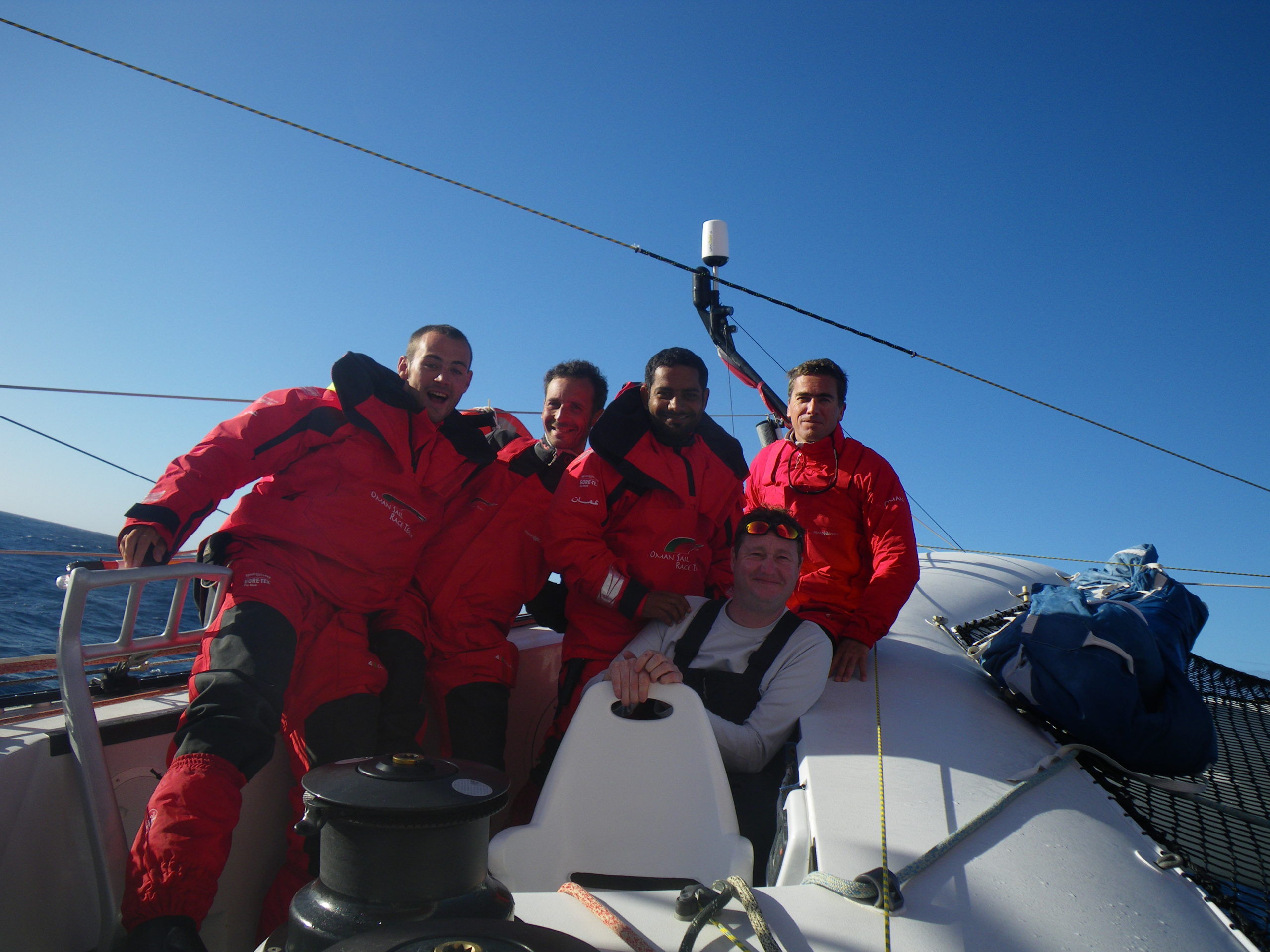
These are great conditions, wind, sun, not to cold, 45d South!
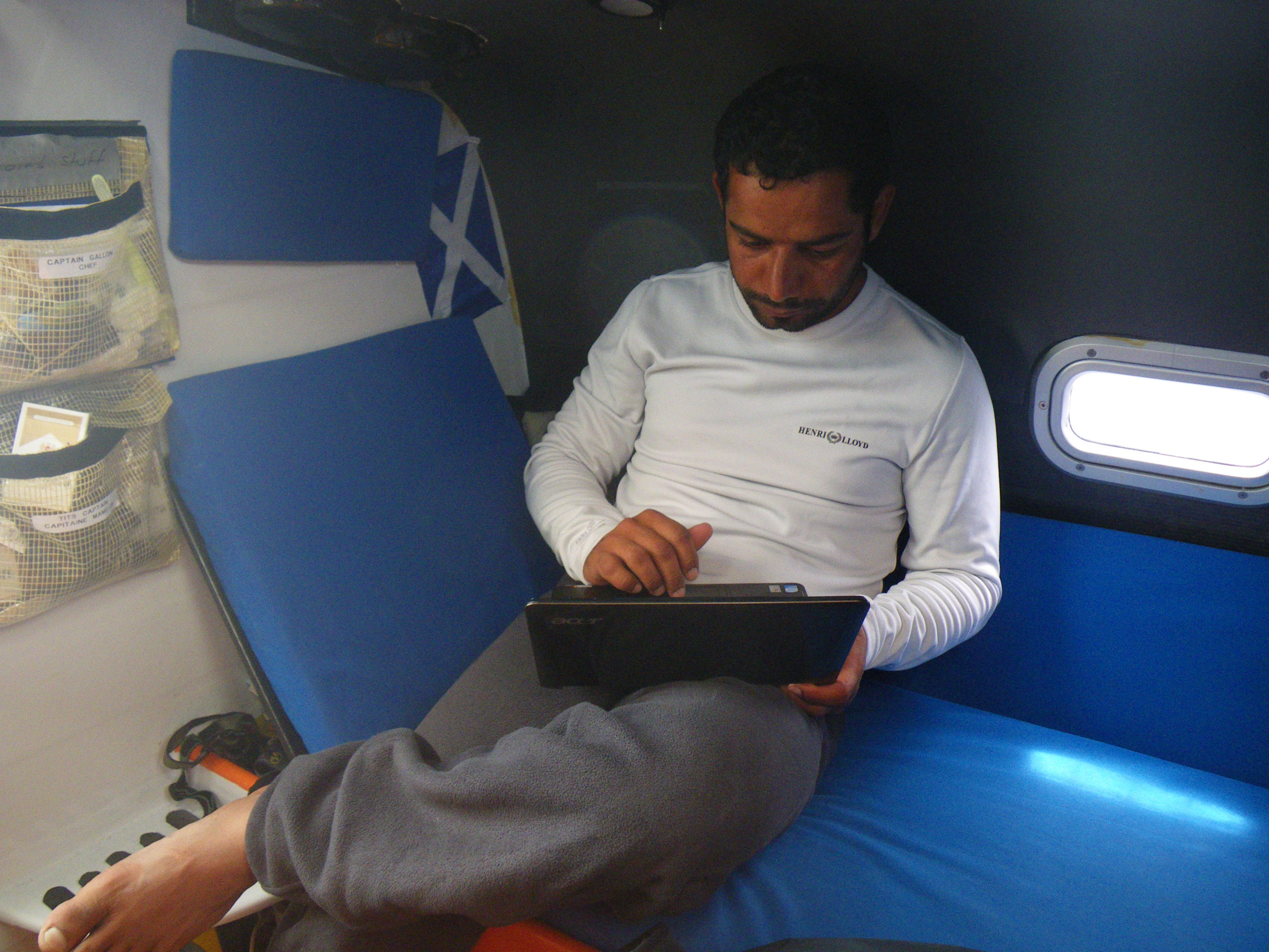
Mohsin emails home explaining life at 45S

Visitors
Email from the boat to shore:
From: OmanTri
To: update
Subject: wed 28th
Date: 28/01/2009 03:20:00
the last 24 hours have been good to us. We managed to change the rudder as
you have probably seen in the video – Loik got dressed up in his imersion
suit incase we needed some assistance from the water ( normally not – but
good to be prepared) and the new rudder was prepared in it’s sling with
weights, from start to finish the operation took just 30 mins – the old
rudder came out fairly easily with the help of a boat hook, and the new one
went in after a little time waiting for the right wave and the right
position on the wave – as the hull lifted Loik pulled the new blade vertical
and kept pulling as the wave passed and the hull came down neatly onto the
rudder – it could have be so hard yet this time if just went right for us.
I have to say the same about the weather – until about 40 mins ago we had
been sailing since the rudder replacement with full main and gennaker
getting some great speeds going and in the right direction – downwind, and
during daylight – clear skies and hot sun. It’s hard to believe that this
is the southern ocean – we are 44 degrees south, the tempreture on deck is
14 degrees C and here at the chart table it’s 20 degrees ! the sun
cascading though the cabin windows making like a green house! We all know
all to well how this can change and how quickly it can happen – for now we
are thankful that our equator gifts to neptune have gone down so well. Loik
is enjoying driving right now at 22kts! with the genoa and 1 reef in the
mainsail – the sea conditons requiring this combination – we have a two
direction swell and when they meet it’s hard to know which way to put the
boat – down to the stbd side the boat bears away a long way slowing down and
an outside risk of sliding into a gybe, or up to port where the boat powers
up and flies down the wave. Judging by the 25kts on the speedo – loik is
choosing to head up rather than bear away for now!
A word about our boat hook – this is an extendable aluminium pole with a
plastic hook on the end – which can be used to pick up lines from the water
or to reach a mooring bouy. This being a lightweight carbon fibre racing
yacht you’d expect us to have some high tech version. But we have the same
as any cruising yachtsman would recognise – aluminium pole with a plastic
clamp half way to control the extension -and just like any cruising
yachtsman’s boat hook it lives in the sail locker and has a hard life – this
means the extension part of the tube gets dented and makes it difficult to
extend – so a combination of brut force and ingnorance is required to get it
to extend ( or reduce to be stored away ) – so it’s not all high-tech toys
here….bucket and sponge are regulation issue too!
Since getting this far south we have also had the pleasure of the company of
a few famous Albertross, we haven’t had a visit from an GIGANTIC ones yet –
but these are a fair size, one just a few mins ago kept circling the boat –
approacing from behind and to leeward, before accelorating past the boat (
remember we are doing 25 kts ! ) and wheeling round the bow across to our
portside and heading aft in a great loop – all teh time head cranked to
the left to check us out. I can imagine as few of them thinking – “i am
sure i saw this boat a few years back – but there are more people, and she’s
a different colour” Despite being so close to the boat – the moment they
catch site of a camera – they at least double or more their distance from
the boat – the totally know if you have a camera, and the ones so far are a
bit too camera shy.
In our quest to get take the photos of these wonderful birds, we shot over 200 pictures….and still struggled to pick a good one.
Boat hook
Weather Router’s advice:
From: Commanders’ Weather
To: Musandam
Subject: Weather 1/28/09
Date: 28/01/2009 14:29:34
To: Charles Darbyshire and the crew of
“Musandam”
From: Commanders Weather Corp
Event: sail around the world
Last Position: 45 14s/128 26e at 1230utc Wed, Jan 28
Prepared: 1330utc Wednesday, Jan 28, 2009
SummaryÖ
1) Very much like your more southerly position ñ always more wind speed to
the S
a) remember, nice stable N and NW winds preceding the cold fronts and
this is the very best place to be
b) will continue to be a struggle on deciding when to go NE for the Cook
Strait, but think the key will be to stay SE and E of the approaching high
pressure cell and then we will head NE to the Cook Strait on the forward
edge of the high pressure cell, as it heads for NZ. That is the plan right
now
c) there will be 2 cold fronts to deal with and the 2nd will be quite
strong
2) 1st cold front still well to the SW and W, near 50S/118E to 45S/111E
a) small high near 47-48S/148-150E and the primary big high is near
38-40S/163-165E
3) NW-N winds will tend to ease and may back a little bit in about 12-18 hrs
a) still want to stay on port gybe, but sail as deep as possible. If
winds get too light 10-12 kts or less, then we may have to gybe
4) Cold front will tend to weaken and move more SE than E, as high pressure
holds S of Tasmania
a) this is why I prefer the more southerly route, but
b) the more southerly route will bring you closer to the cold front and
also more wind speed
c) winds will back for certain more into the WNW, but I hold port gybe
and take this leftie to the ENE, provided wind speeds don’t get too light
d) cold front may touch you briefly Fri morning with a wind shift into
the WSW ñ will be obligated to gybe to starboard with a W or WSW wind, but
5) Another, stronger cold front right behind this weakening front
a) at 1200UTC Fri ñ lots of high pressure to the NE, N, and NW of you,
but trailing cold front should clear these high pressure cells out of your
way
b) any W or WSW wind behind the 1st front will be brief and when winds
start moving right/veer, gybe back to port gybe and sail as fast as possible
to the E or ENE ñ best angle to sail fast
6) Strong cold front will pass Sat morning, around 00UTC
a) this will be a strong front and trailed by a strong high pressure cell
b) once again, fast to the E ñ want to stay ahead of the high pressure
cell
c) this high will approach from the SW, so winds will back and head you,
which will allow you to go NE in the Tasman Sea, staying west of South
Island
7) The big high pressure area will be near 46-47S/138-140E at 1200UTC Sat,
45-47S/155-158E
1200UTC Sun, and 42S/162E at 1200UTC Mon
a) key to the strategy is staying E and NE of the high pressure cell
8) Because of the height of the Southern Alps on South Island, the high
pressure will wrap around
the S side of South Island
a) this will leave a low pressure trough near Cape Farewell, the NW
corner of South Island
b) right now, I will be aiming for 40S/170E and then E, into the Cook
Strait, avoiding the light winds near the western shore of South Island
RoutingÖ
1) Port gybe ñ better to the SE than fast to the ESE
2) Hold port gybe as winds back unless wind speeds fall to 10-12 kts or
less, but
3) May have to go to starboard gybe if cold front touches you and winds
become more W or WSW
4) Back to port gybe with NW winds ahead of the strong cold front ñ need as
fast as possible to the E
and ESE on Fri night
5) When cold front passes, starboard and as fast to the E and NE as possible
a) need to stay ahead of the trailing high pressure cell ñ if slow, we
will get trapped in the high pressure cell well S and SW of the Cook Strait
Wind directions are TRUE, wind speed in kts, and time is UTC
Wed, Jan 28
18: 340-320/16-22
WeatherÖPartly cloudy to cloudy with W to SW swell of 6-9 feet or less
Thu, Jan 29
00: 330-350/11-17, no choice need to be on port, but if winds back and
diminish may have to put a small starboard gybe in to the SE
06: 330-350/12-17
12: 330-300/14-20 nr 47s/137e
18: 300-270/14-20, gust/squall 30
WeatherÖPartly cloudy to cloudy with a chance of a squally shower or 2 at
night. W to SW swell of 5-8 feet
Fri, Jan 30 ñ Winds lighter N and stronger S
00: 280-250/ 8-14, starboard gybe
06: 270-300/10-15
12: 300-320/12-17, nr 46 50s/145e
18: 300-270/12-18, still on port and getting ready to gybe
WeatherÖChance of a morning squally shower with the 1st cold front and then
scattered squally showers with the stronger cold front late at night. W-SW
swell 5-7 feet, but increasing after midnight
Sat, Jan 31
00: 270-240/15-21, gust/squall to 20-25 kts
06: 220-250/20-26, gust/squall to 30 kts
12: 210-230/20-30, near 46S/153 20 ñ as fast as possible on starboard to
stay ahead of the trailing high
18: 210-190/20-30
WeatherÖConsiderable cloudiness with scattered squally showers, which will
end when winds are more S and SE. SW swell up to 8-12 feet
Sun, Feb 1
00: 190-170/16-22
06: 180-160/15-21
12: 170-150/12-18, near 44 55S162 10E
18: 170-150/14-20
WeatherÖPartly cloudy with diminishing SW-S seas
Mon, Feb 2
00: 200-180/16-22
12: 200-180/14-20, near 41 45S/168 30E
Partly cloudy to fair
Best regards, Ken Campbell
—
PLEASE NOTE: AS OF JANUARY 1, 2008, OUR NEW EMAIL ADDRESS IS :
info@commandersweather.com
Commanders Weather Corp.
Tel: 603-882-6789
A selection of pictures from today: