Lat: 46 18.41′ S
Long: 164 39.75′ W
Inst Speed: 15.2
Wind Dir: 219
Wind Speed: 23.2
Distance last 24hr: 403.65
Distance to finish: 12614.91
Long: 164 39.75′ W
Inst Speed: 15.2
Wind Dir: 219
Wind Speed: 23.2
Distance last 24hr: 403.65
Distance to finish: 12614.91
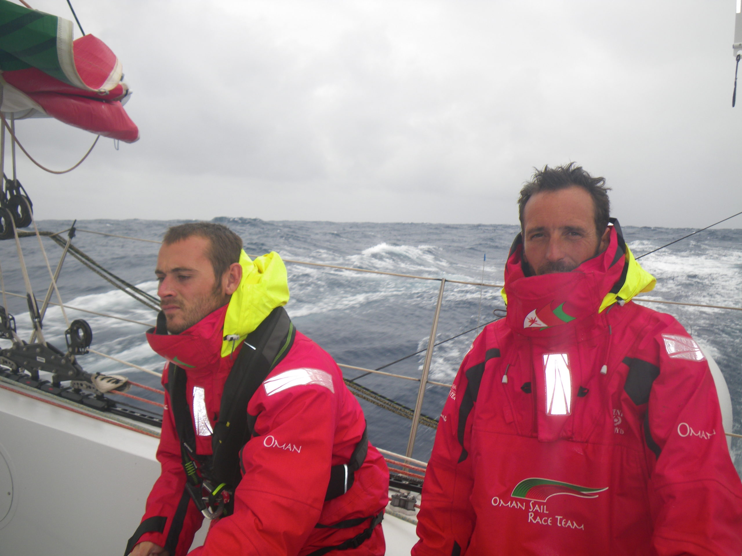
Sailing in the south requires concentration
well most of the time
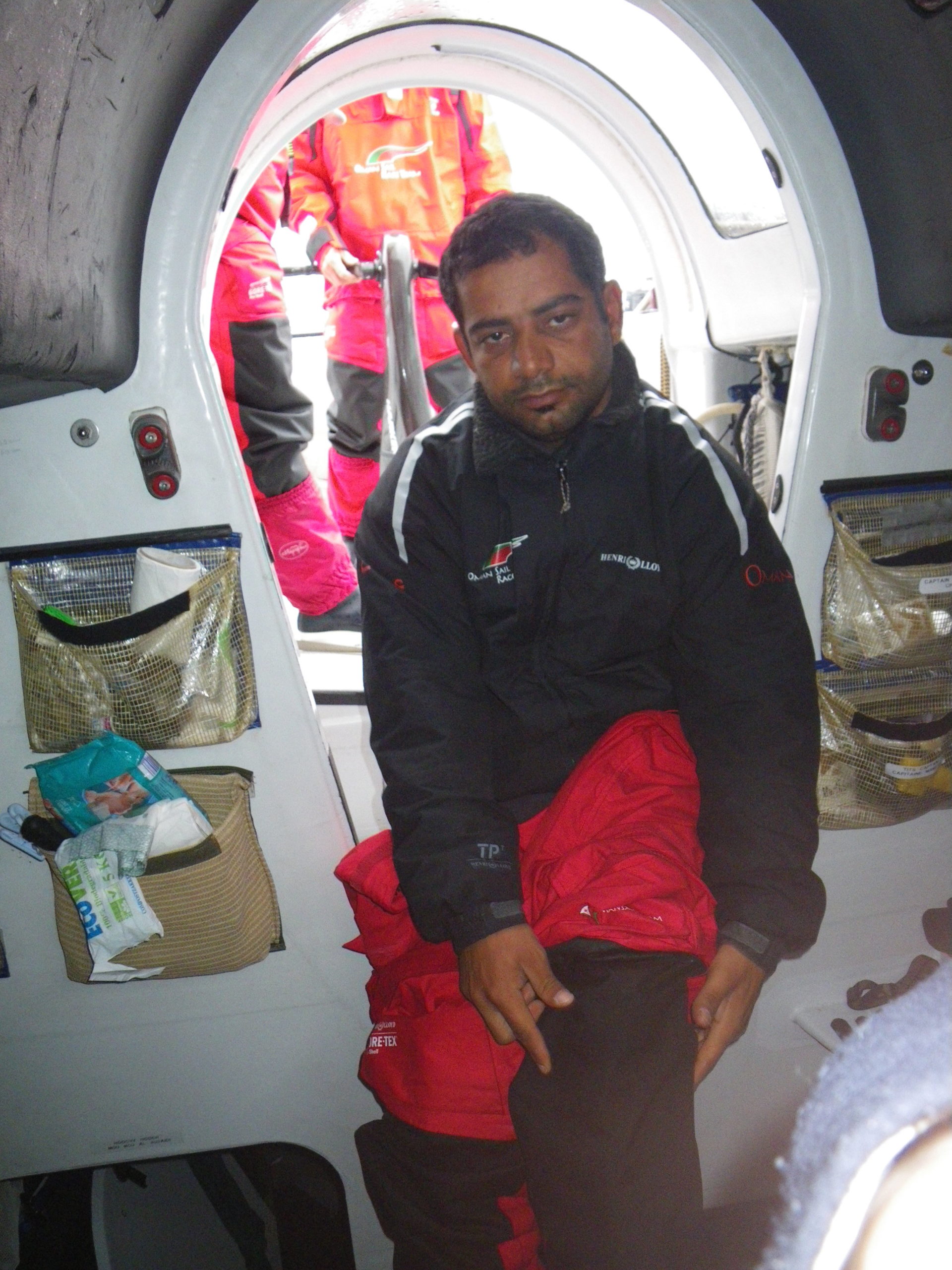
Mohsin pull his gear on for another watch
Email from the boat to shore:
From: OmanTri
To: update
Subject: Friday Morning
Date: 06/02/2009 03:49:26
We have had a fairly resonable 24 hours since yesterday – there is an
unpleasant sea on top of difficult swell meaning we must sail deeper than
we really should be – and hence we are slower – which means we get hit by
more waves, which reduces our speed again! It’s catch 22 but the
alternative is to try to blast away and risk doing damage – the motion and
the noise is bad enough already so to risk anything further seems
pointless – we just have to wait of the sea to sort itself out. In these
conditions we have had a recourance of a small bug in out instrument and
autopilot system. It seems related to the waves but we’ve hit some big
seas and nothing happens – then all of a sudden the system will be off for a
few seconds before coming back on…it’s possible to live with it, just, but
we are keen to find the cause of the problem and resolve it incase it
started to get worse. It been occupying a few minds for a while now, if it’s
a loose connection somewhere it’s like looking for a needle in a hay stack
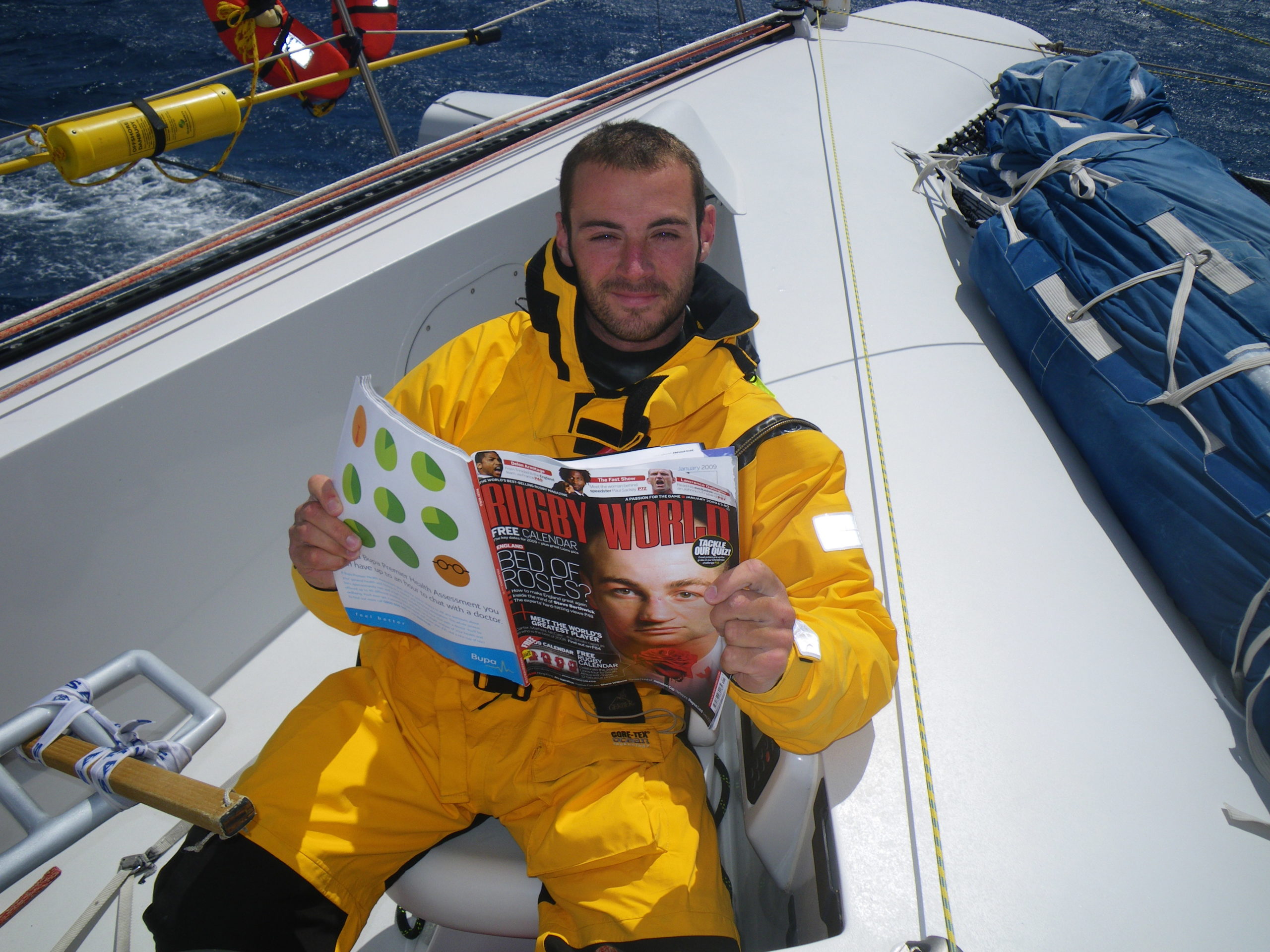
Apart from that life continues as normal, it’s been wet enough on deck for
Loik to be the first to break out the yellow suite – a one piece dry suit
that has full wrist and neck seals, the red wet weather gear giving up the
unequal struggle between the sea and dry clothes beneath! I’d expect
everyone else to follow suit in the next 24hours or so, and this will be out
outer layer for a long time – likely at least until south of Cape of Good
Hope. Imagine standing in the cockpit with 5 or 6 people throwing full
bucket of water over you – that’s what some of the waves feel like. The
water is still fairly warm ( around 15degrees ) and much of today so far
it’s partly sunny – so it feels warm – later in this leg the water
tempreture will plunge – requiring these drenchings to be avoided at all
costs, rather than suffered as they are now.
The motion down below is quite unreal – especially when Loik or Theirry
have the helm – they nail it down the face of the wave during which time
there is speed wobble sort of side to side wobble, then as we bottom out and
go up the next wave the boat slows and you move forward and left as the boat
is headed up to gather speed for the next wave – the longer the wave length
the longer each cycle of events takes, in current short seas it’s madly
short, and it makes life down below – sleeping , or pouring water into a
meal, or cup , or typing on the computer a real challenge. I now seem to be
able to sleep with one hand on the side of the bunk to hold myself in, which
is a habit I need to get out of before making the return to the real world !
Taking a reef or taking out a reef in these conditions is a bit of a
challenge – with the main pinned against the leewards shrouds, you have to
wait as it inches upwards, one every wave you get chance with the pressure
off to take a good chunk of halyard, then it’s back to inching it’s way once
again – even with 3 people grinding it’s a drag – but equally with 3 it
really doesn’t take that long. It’s a full on long job for the solo sailor
and we are greatful to be 5 onboard – with help just a meter or two away
asleep by the chart table.
To: update
Subject: Friday Morning
Date: 06/02/2009 03:49:26
We have had a fairly resonable 24 hours since yesterday – there is an
unpleasant sea on top of difficult swell meaning we must sail deeper than
we really should be – and hence we are slower – which means we get hit by
more waves, which reduces our speed again! It’s catch 22 but the
alternative is to try to blast away and risk doing damage – the motion and
the noise is bad enough already so to risk anything further seems
pointless – we just have to wait of the sea to sort itself out. In these
conditions we have had a recourance of a small bug in out instrument and
autopilot system. It seems related to the waves but we’ve hit some big
seas and nothing happens – then all of a sudden the system will be off for a
few seconds before coming back on…it’s possible to live with it, just, but
we are keen to find the cause of the problem and resolve it incase it
started to get worse. It been occupying a few minds for a while now, if it’s
a loose connection somewhere it’s like looking for a needle in a hay stack
Apart from that life continues as normal, it’s been wet enough on deck for
Loik to be the first to break out the yellow suite – a one piece dry suit
that has full wrist and neck seals, the red wet weather gear giving up the
unequal struggle between the sea and dry clothes beneath! I’d expect
everyone else to follow suit in the next 24hours or so, and this will be out
outer layer for a long time – likely at least until south of Cape of Good
Hope. Imagine standing in the cockpit with 5 or 6 people throwing full
bucket of water over you – that’s what some of the waves feel like. The
water is still fairly warm ( around 15degrees ) and much of today so far
it’s partly sunny – so it feels warm – later in this leg the water
tempreture will plunge – requiring these drenchings to be avoided at all
costs, rather than suffered as they are now.
The motion down below is quite unreal – especially when Loik or Theirry
have the helm – they nail it down the face of the wave during which time
there is speed wobble sort of side to side wobble, then as we bottom out and
go up the next wave the boat slows and you move forward and left as the boat
is headed up to gather speed for the next wave – the longer the wave length
the longer each cycle of events takes, in current short seas it’s madly
short, and it makes life down below – sleeping , or pouring water into a
meal, or cup , or typing on the computer a real challenge. I now seem to be
able to sleep with one hand on the side of the bunk to hold myself in, which
is a habit I need to get out of before making the return to the real world !
Taking a reef or taking out a reef in these conditions is a bit of a
challenge – with the main pinned against the leewards shrouds, you have to
wait as it inches upwards, one every wave you get chance with the pressure
off to take a good chunk of halyard, then it’s back to inching it’s way once
again – even with 3 people grinding it’s a drag – but equally with 3 it
really doesn’t take that long. It’s a full on long job for the solo sailor
and we are greatful to be 5 onboard – with help just a meter or two away
asleep by the chart table.
Weather Router’s advice:
From: Commanders’ Weather
To: Musandam
Subject: weather 1430 utc Fri 2-6
Date: 06/02/2009 14:42:27
To: Charles Darbyshire and the crew of
“Musandam”
From: Commanders Weather Corp
Event: sail around the world
Last Position: near 47 02s/161 11w at 13 utc Fri Feb 6, 2009
Prepared: 1400utc Fri Feb 6, 2009
SummaryÖLots of wind and sea in the week ahead.
1) High pressure is centered north near 40s/165e at 12 utc.
2) This high will stretch out to the E and weaken over the next few days.
3) Your breeze will tend to diminish a little and also clock to W-WNW next
12-18 hours.
4) Then as frontal system approaches from the W your wind will increase and
continue to clock to NW
Sat.
a) We have you heading E on port gybe close to 47s
5) If you continue to move close to 20 kts you will stay ahead of this front
possibly into early next week.
6) GFS model guidance has low pressure near 46 30s/125e heading SE early
next week.
7) We have to be careful we do not get into the circulation of this low so
at this time recommend turning
more ESE as winds back to NNW Sunday /Monday.
a) This will keep you S of the ice gate so keep an eye out
for Icebergs/growlers as you get
east of 150w
8) Your winds will diminish Monday but if all goes well you will stay away
from adverse winds from the
low which will track SE northeast of your expected positions.
9) Then attention will turn to a large low to your SW which will be near
55s/150w at 12 utc Mon.
a) This low will track to 56s/ 125 e by 12 utc
Tue and to 57s/ 105e by 12 utc Wed.
10) This system is large and will be tough to avoid its strong winds and
high seas.
11) Could see very rough conditions develop 00-12 utc Tuesday with NW winds
35-50 kts and seas
building to 15-25 ft.
12) Will monitor this to see how best to handle it next few days ñ it may be
better to get even further S
mid to late week closer to low to minimize winds and seas.
RoutingÖ some southing thru 00 utc then onto port as winds back to NW and
heading E close to 47s
Thru 00 utc Sun.
Around 00 utc Sun you may need to edge S as winds clock
to NNW to avoid possible low
Tracking SE to your NE
You will remain S of the eastern ice gate Sat night/Sunday
by 100-150 miles so keep an
eye out for possible icebergs/growlers.
Continue with some southing first half of the week and
may need to get further mid to late
week as winds and seas will be less closer to the low to
your S.
Estimated positions listed below
Wind directions are TRUE, wind speed in kts, and time is UTC
Fri, Feb 6
18: 250-270/ 25-32
WeatherÖvariable cloudy with a squally shower possible
Seas near 15 ft, wind wave chop with SW swell
Sat, Feb 7 ñ increasing W-NW to NW wind ahead of cold front ñ now on port
00: 260-280/ 22-30
06: 280-300/ 22-30
12: 290-310/ 25-35 nr 47s/151 30w
18: 300-320/ 30-40
WeatherÖPartly cloudy to cloudy
Seas 12-17 ft, rough chop with SW swell
Sun, Feb 8 ñ NW wind ahead of cold front, but diminishing late as front
nears
00: 310-330/30-40
06: 310-330/30-40
12: 320-340/30-40 nr 47 30n/140w
18: 320-340/25-35
WeatherÖMostly cloudy with risk scattered squally showers and gusts over 40
kts
Seas 10-15 ft, SW swell
Mon, Feb 9
00: 330-350/25-32
06: 330-350/25-20
12: 330-350/18-25 nr 50 s/130w
18: 320-340/22-30
WeatherÖConsiderable cloudiness, squally showers possible
Seas 10-15 ft, SW swell
Tue, Feb 10
00: 320-340/25-35
06: 320-340/30-40
12: 320-340/35-45 nr 52s/117w
18: 300-320/30-40
WeatherÖConsiderable cloudiness, squally showers possible
Seas building to 15-20 ft
Outlook for Wed Feb 11
00: 290-310/ 25-35
12: 280-300/ 25-35 nr 53s/ 103w
WeatherÖConsiderable cloudiness
Seas 15-25 ft- less to south closer to low.
Best regards, Tom Mattus
—
PLEASE NOTE: AS OF JANUARY 1, 2008, OUR NEW EMAIL ADDRESS IS :
info@commandersweather.com
Commanders Weather Corp.
Tel: 603-882-6789
A selection of pictures from today: