Lat: 47 34.93′ S
Long: 95 26.81′ W
Inst Speed: 9.9
Wind Dir: 265
Wind Speed: 22.8
Distance last 24hr: 353.54
Distance to finish: 10032.91
Long: 95 26.81′ W
Inst Speed: 9.9
Wind Dir: 265
Wind Speed: 22.8
Distance last 24hr: 353.54
Distance to finish: 10032.91
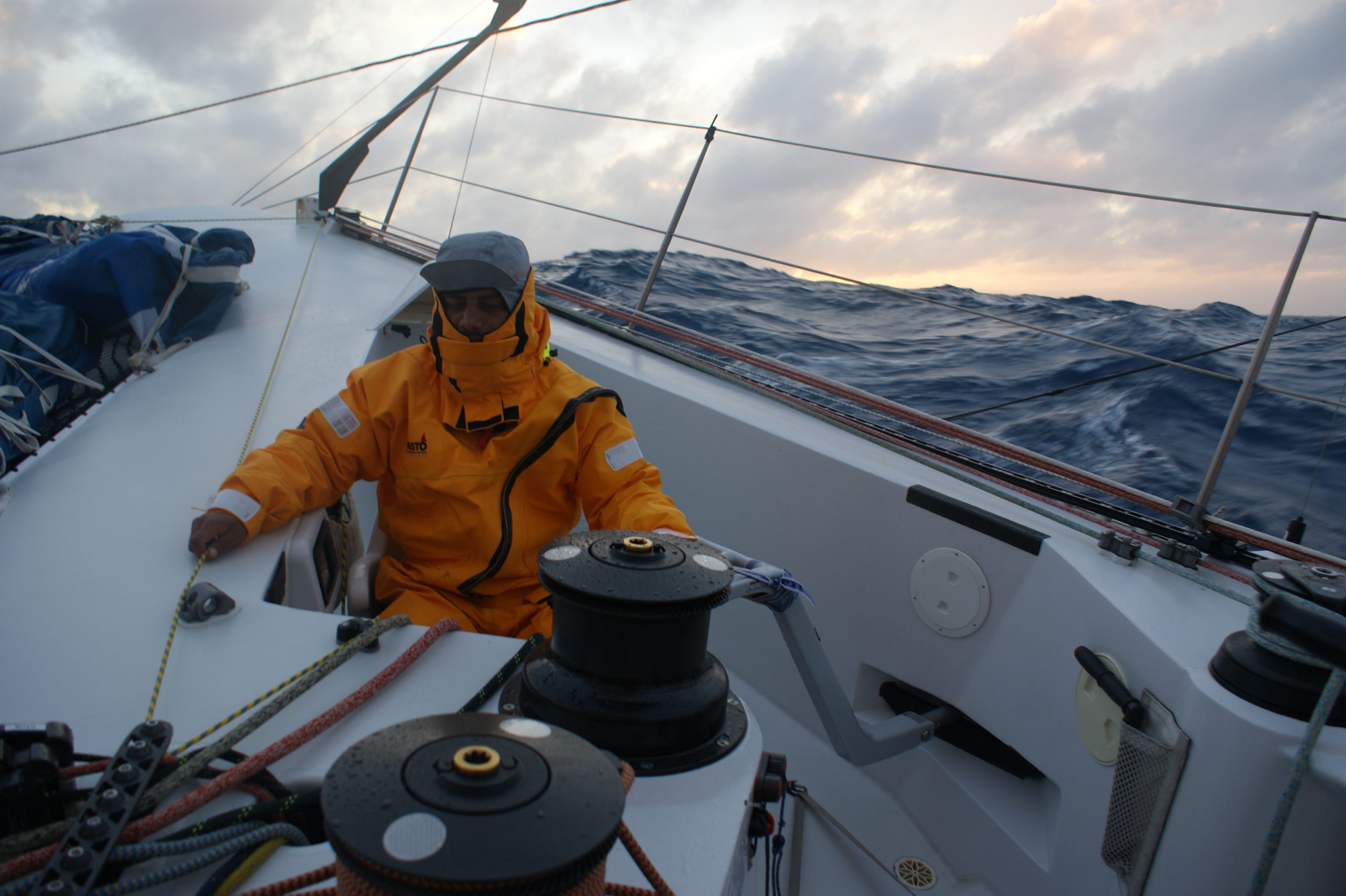
Mohsin driving us eastwards

Sunset
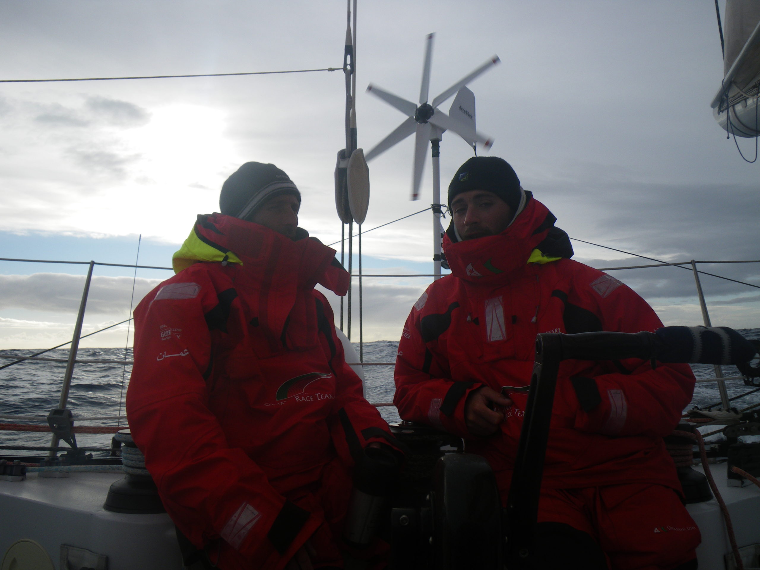
on watch chats
Email from the boat to shore:
From: OmanTri
To: update
Subject: Saturday 14th Feb
Date: 14/02/2009 01:30:09
We have gybed, and for now we are aiming exactly at Cape Horn 1120nm away-
most likely 3days ahead of us. we are using two different weather models
onboard and they don’t completely agree as to what weather we are going to
get between here and there. Chances are we will see conditions moderate –
the are already significantly better than 12-18 hours ago where we were
being bounced along with 3 reefs and small staysail jib, we have manged to
get the solent out, and have 2 reefs in the mainsail in 25 kts of wind, and
a much improved seastate. We have suffered this whole pacific leg of the
trip from not having the big rolling swells that we could get on scream
down the face of. The seas so far have had a swell from one direction and
waves on top of that making life so very uncomfortable. Since the gybe and
the reduced winds ( we did see gusts to 48kts) this top wave has reduced a
lot, and we do now have the swell.
Life onboard continues to roll along – it’s going quite quickly, in fact it
comes as a surprise when it’s time to invoke our new day routine – write
update, send some video, get food out etc. but after the last few days of
rain and waves over the boat there is a fair amount of water down below,
it’s not the water you can mop up with a sponge and pour away – the surfaces
are damp, mid layers, and hats are damp, there isn’t enough storage space in
the cuddy for all wet weather gear so some has to come down below bringing
with it another deluge – it’s a long while away , but the dry conditions we
expect to have in the indian ocean will be a welcome chance to get things
out and give them a proper drying – for now we have to manage as best we can
without creating a rain forest down below ( the back cabin has been like
that for a little while now), and i fear that once we remove the water
proofing tape from the hatch and allow daylight to stream in we’ll allow
photosynthysis to occour and all sorts of exotics will take root.
It’s just going dark here now (0130 GMT) and we have some nice clouds and an
enormous sun to wish us good night – it’s a bit too easy to take each
sunrise and sunset for granted as there are a lot of good ones, so we’ll
film this one for your enjoyment when we get back….. for now – it’s off
into the night , and waiting for the moon to raise and light our night….
Weather Router’s advice:
From: Commanders’ Weather
To: Charles Darbyshire , Musandam ,updateoman
Subject: weather Sat 2-14
Date: 14/02/2009 13:25:40
To: Charles Darbyshire and the crew of
“Musandam”
From: Commanders Weather Corp
Event: sail around the world
Last Position: 49 26s/ 93 28w at 1145utc Sat Feb 14, 2009
Prepared: 1300utc Sat Feb 14, 2009
SummaryÖ a couple of slow days then brief N gale Sunday night/Monday.
1) Low pressure trough to your W will evolve into small low pressure system
near 49s/89w by 00 utc
Sun.
2) With the low nearby next several hours your winds could drop briefly to <
10 kts.
3) Then will freshen from the S after 00 utc Sun as the low pulls away.
4) Winds speeds increase to 15-20 kts by 12 utc Sun and will be stronger to
the N and lighter to the S
of your expected position.
5) But this breeze will be temporary as well as narrow high pressure ridge
moves thru around 18 utc
Sun dropping your winds briefly down to 10 kt range.
6) Then attention turns to next front approaching from the W .
7) Expect your winds will back into the NW-N with speeds building to 30-45
kts off the SW tip of South
America as the wind gets concentrated there 12 utc Mon.
8) Fortunately this front moves on thru by 18 utc Mon so the N gale lasts
about 12 hours before winds
shift to WNW and diminish Monday pm.
9) Then with low pressure to the SE and SW of Cape Horn expect W-WNW winds
as you round Cape
Horn in the 25-35 kt range
10) E of Cape Horn winds will diminish Tue night and Wed and could get quite
light Thu E of the
Fauklands.
11) Will want to avoid that area of light air if possible but that far out
subject to change.
12) Will want to know if your ice people have any specific areas to avoid in
the South Atlantic.
a) For now expect you will want to route NE from Staten
Island, north of rhumb line not
wanting to turn E until 45s to minimize ice
threat.
13) Let us know what you think.
RoutingÖGeneral direction toward 56s/ 70w south of Cape Horn tacking and
gybing as needed.
– Some estimated positions below
Wind directions are TRUE, wind speed in kts, and time is UTC
Sat, Feb 14
18: 270-290/4-8
WeatherÖConsiderable cloudiness with risk few showers
Seas 15-20 ft WSW swell slowly diminishing
Sun, Feb 15- winds stronger N , lighter S
00: bcmg 200-180/ 8-12
06: 180-250/10-15
12: 180-200/15-20 nr 51s/86w
18: 220-240/ 8-12
WeatherÖ Mostly cloudy risk few showers.
Seas diminishing to 8-12 ft WSW swell
Mon, Feb 16
00: 320-340/15-20
06: 340-360/25-35 g 40
12: 350-010/30-45 nr 54s/77w
18: 320-280/40-30 ñ winds diminish and back
WeatherÖMostly cloudy with squally showers possible
Seas increase to 10-15 ft
Tue, Feb 17
00: 280-300/18-25
06: 270-290/25-32
12: 290-310/25-32 E of Cape Horn, S of Staten Island
18: 290-310/25-35
WeatherÖCloudy to partly cloudy
Seas 8-12 ft W swell
Wed, Feb 18
00: 280-300/ 15-22
06: 250-270/ 15-22
12: 250-270/ 15-20 ESE of Faukland Islands.
18: 250-270/ 10-15
WeatherÖ.Considerable cloudiness
Seas 8-12 ft W swell
Thu, Feb 19
00: 270-290/ 5-10
12: 290-310/ 5-10 nr 51s/ 48w
WeatherÖVariable cloudiness
Seas 6-10 ft W swell
Best regards, Tom Mattus
—
PLEASE NOTE: AS OF JANUARY 1, 2008, OUR NEW EMAIL ADDRESS IS :
info@commandersweather.com
Commanders Weather Corp.
Tel: 603-882-6789
A selection of pictures from today: