Lat: 9 39.11′ S
Long: 72 41.19′ E
Inst Speed: 2.3
Wind Dir: 314
Wind Speed: 2.7
Distance last 24hr: 182.39
Distance to finish: 19499.16
Long: 72 41.19′ E
Inst Speed: 2.3
Wind Dir: 314
Wind Speed: 2.7
Distance last 24hr: 182.39
Distance to finish: 19499.16
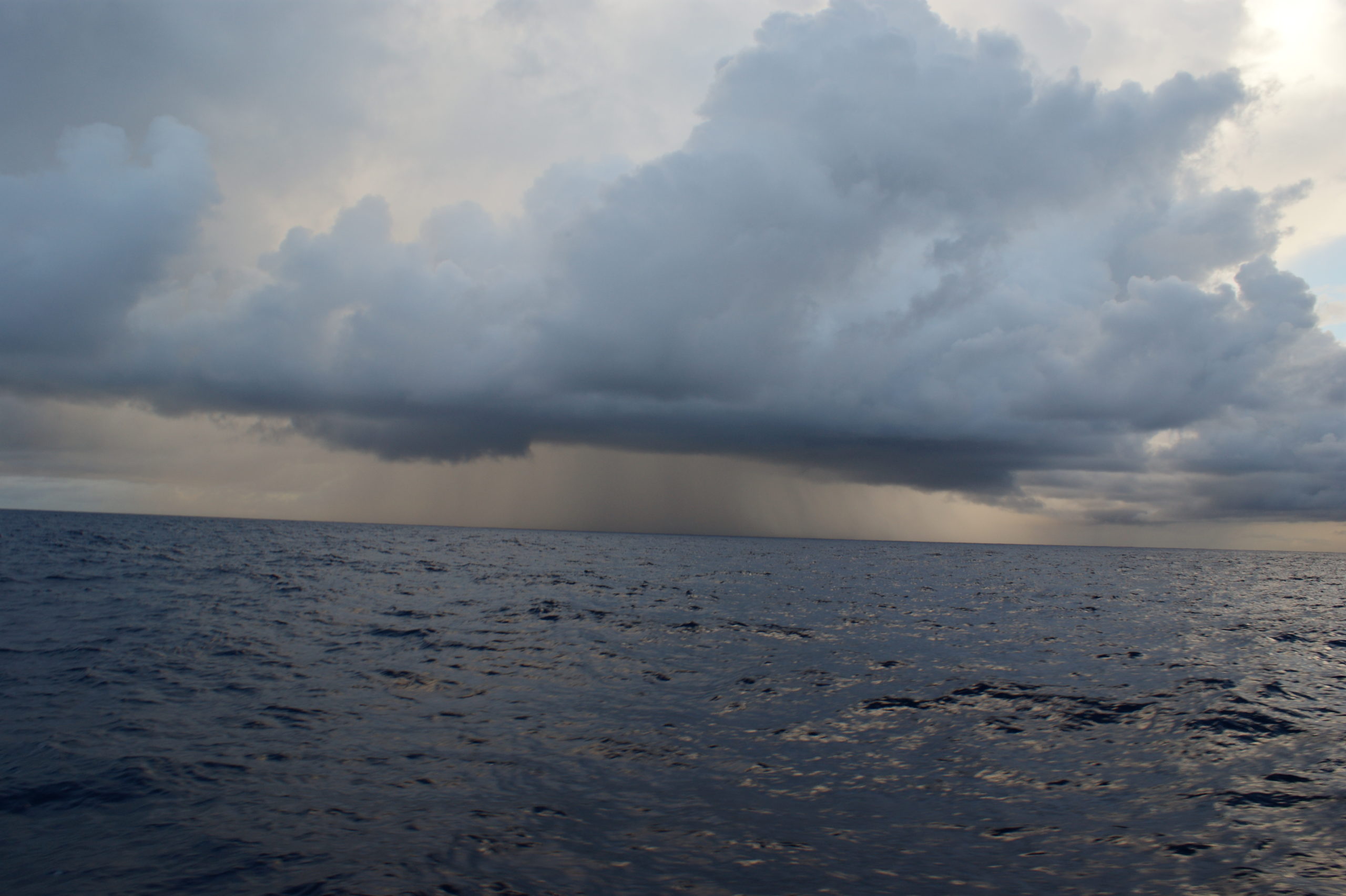
The rain coming our way
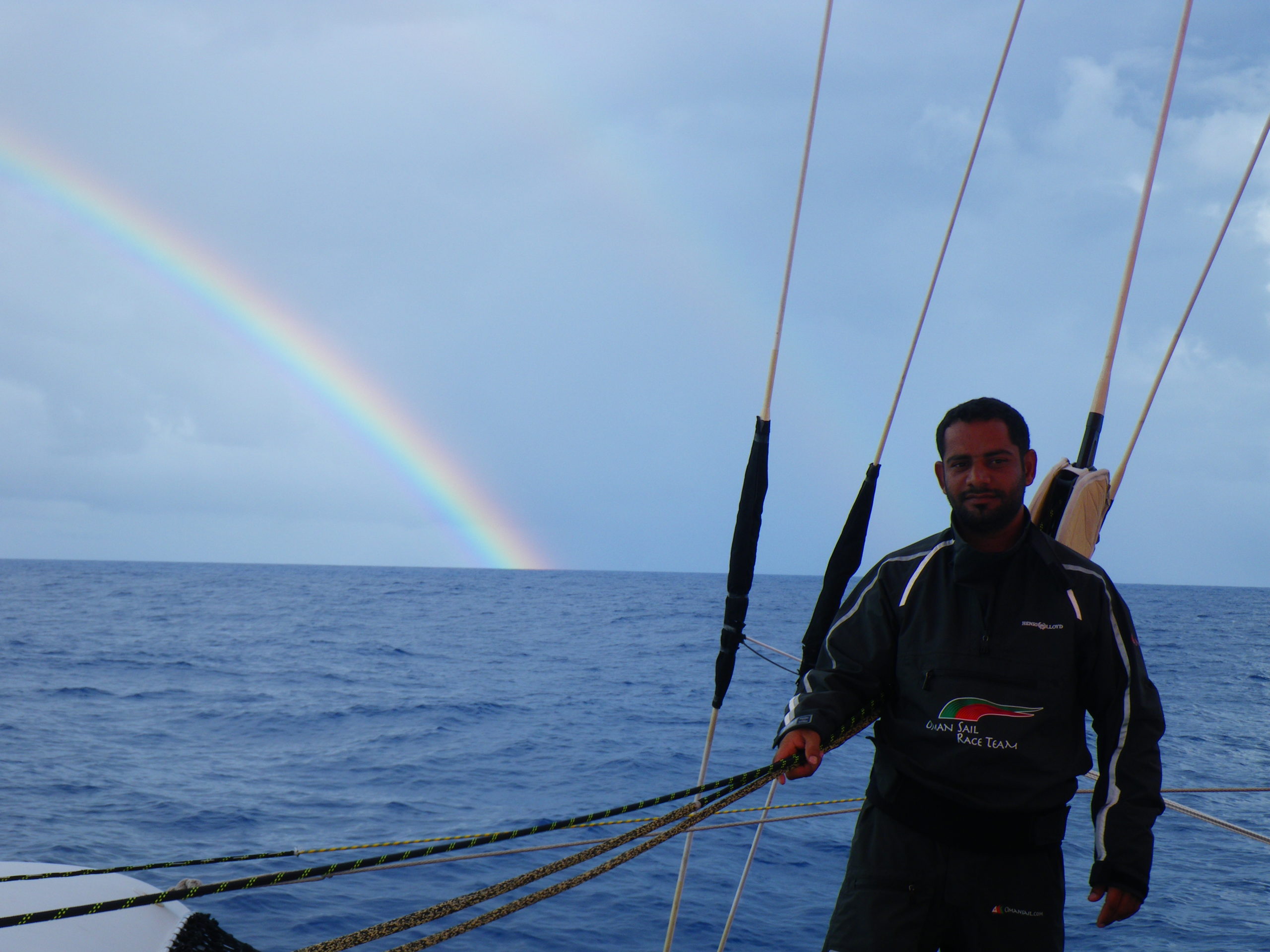
Mohsin looking for a pot of gold

Looking out of the hatch in the main hull at the rain
Email from the boat to shore:
From: OmanTri <omantri@
To: update <updateoman@
Subject: Rain
Date: 16/01/2009 05:39:28
The last 24 hours have been incredible…
we have quite a bit of breeze that we shouldn’t have had, and now as I write
this we don’t have the breeze we should have. It’s very much like the
doldrums here – the most predicatable thing about the doldrums is it’s
unpredictableness. We did think yesterday afternoon that we were off –
heading SE towards a point where the winds would go light, then shift to the
SE and allow us to tack and head S, but nothing is quite so easy, and we are
once again struggling with very light airs indespersed with fairly strong
winds and torrential rains -and i mean torrential, you get as wet from the
rain bouncing off the cockpit floor as you do from the raining coming down
from the sky. The good news – if you are Loik and Mohsin is that this
normally occours on the Th&Hooch watch – they ride out the worst of it whist
the other 3 of us grin at them from the hatch.
During these rain squals you just have to sit and feather the boat, normally
they don’t last too long, and don’t take you the wrong way too much – though
we did have one at at 230 GMT that was big and carried us north for a
hile – not terribly helpful
So for now we are in a transition between the doldrums and the SE/ E winds
that we have been expecting to arrive – once they do we’ll be heading south
rapido – but we can’t do anything without them – so for now for the on deck
crew it’s abot making progress as best as possible ( and trying to stay
dry!) We have wind from 335 right now, so we have gennaker and full
mainsail, edging us eastwards
Down below decks we are eating and sleeping OK – clearlly is’t still very
hot and with all this rain super humid, so until we start to head south
properly it’s hard to think about repacking bags to make sure the warm gear
is to hand – we stilll have a couple of days to sort that out – but it’s in
our minds for sure.
Weather Router’s advice:
From: Commanders’ Weather <info@
To: Musandam <omantri@
Subject: weather
Date: 16/01/2009 13:59:01
To: Charles Darbyshire and crew of “Musandam”
From: Commanders Weather Corp
Event: sail around the world
Last Position: 9 36s/ 73 04e at 1200utc Fri, Jan 16, 2009
Prepared: 1330utc Fri, Jan 16, 2009
SummaryÖ
Satellite imagery showed lots of showers/squalls near/around you earlier and
course on tracker showed you heading in lots of different directions ñ Were
you trying to get away from these and are you mainly east of them now ñ it
does look that way on sat imagery
1) Latest sat pics show less clouds/showers and most activity west of you
2) Flow should be backing and becoming more E
a) expect wind speeds to come up more as they back with the lesser shower
activity
3) Come more S as the flow backs
4) The wind should become E then may edge right again after 06utc Sat
a) flow may be somewhere between 100-120
5) Can then come a little W of S
6) We should maintain good wind speeds over the weekend
7) Flow will begin to back on Mon
8) Maybe aiming towards 25s/71e then ternding more SSE in course
9) There will be big high pressure late weekend/early next week around
35s/90e that may then tend to edge more NW as we get into next week
10) We will want to see where exactly that high will be
11) Flow will continue to back early next, becoming N and NW closer to
Tues-Wed, depending on how far south you are
a) we just don’t want to cut the corner too fast
RoutingÖ start coming more S with the backing flow ñ wind then may come a
bit more right again Sat, so best heading will be SSW (basically, a little W
of due S) ñ this will be ok as we don’t want to get too far east too early
and end up too close to the high later on ñ some estimated positions below
We can see how your progress is and where the high will be over the next few
days and can adjust accordingly – maybe starting the more E heading
around/south of 34s
Wind directions are TRUE, wind speed in kts, and time is UTC
Fri, Jan 16
18: 100-080/11-16 ñ hdg S
WeatherÖVariable cloudiness with a few scattered squally showers ñ most
should be off to the west of you, but few may still be scattered about
Seas 3-4 ft – E swell
Sat, Jan 17
00: 080-100/12-17
06: 080-100/13-20
12: 100-120/14-20 nr 14 20s/72 55e
18: 100-120/14-19
WeatherÖPartly cloudy with a few brief scattered trade wind showers possible
Seas build to 4-6 ft
Sun, Jan 18
00: 100-120/14-20
06: 090-110/15-20
12: 100-120/17-22 nr 19 30s/72 20e
18: 100-120/15-22
WeatherÖPartly cloudy, chance of a shower
Seas 6-9 ft
Mon, Jan 19
00: 100-120/15-20
06: 100-120/15-20
12: 080-100/14-19 nr 25 20s/71e – heading more SSE
18: 070-090/12-17 wind diminishing
WeatherÖPartly cloudy
Seas 5-7 ft with an E swell
Tue, Jan 20 ñneed to be careful about getting sucked E into high
00: 060-080/10-15
12: 030-050/10-15 nr 31s/ 72e
WeatherÖPartly cloudy
Seas 4-6 ft
Wed, Jan 21
00: 360-020/13-18
12: 340-360/12-17 nr 33 50s/73 30e
may have to have a jog W prior to this, so as not to get too far E too fast
and get too close to the high
WeatherÖPartly cloudy
Best regards,
George Caras
A selection of pictures from today: